If you are about to make the drive from Kampala to Bwindi Impenetrable Forest, this guide gives you a sequential description of exactly what you will see and experience at every stage of the 490-kilometre journey in 2027 — from the congested traffic leaving Kampala through Entebbe Road to the equator crossing near Kayabwe, the flat agricultural plains around Masaka, the rolling Ankole cattle country between Masaka and Mbarara, the tea estates on the Mbarara-Kabale escarpment, the striking terraced hillsides of Kigezi near Kabale, and the final green, forested approach to Bwindi along the unpaved murram road that delivers you to one of the world’s most remarkable national parks. Knowing what to expect on the road to Bwindi gorilla trekking makes every Uganda safari drive more rewarding.
- Total distance: approximately 460km Kampala to Bwindi Buhoma; allow 8-9 hours driving with a lunch stop
- Paved section: Kampala to Kabale is entirely paved; good quality tarmac throughout; variable surface after Kabale
- Unpaved section: Kabale to Bwindi Buhoma: approximately 50km murram road; allow 1.5-2.5 hours
- Key towns: Masaka (lunch option), Mbarara (fuel/supplies), Kabale (last major services before Bwindi)
If you are about to make the drive from Kampala to Bwindi Impenetrable Forest, this guide is for you. Rather than a general overview, this is a specific, sequential description of exactly what you will see and experience at every stage of the 490-kilometer journey. Read it before you depart so nothing comes as a surprise, and use it as a companion on the road to understand what you are passing through.
Departure: Kampala to Kibuye Junction (0 to 15 km)
Leaving from a hotel in central Kampala or from the Entebbe direction, the first section involves navigating Kampala’s roads to the Masaka Road exit. Your driver uses one of several routes depending on traffic and time of day. You pass through busy suburbs — Makindye, Nsambya, or Kibuye depending on the route. The city is dense, loud, and full of movement. Boda bodas thread between vehicles. Matatus stop unpredictably. This is Kampala in full operation. Clear the city and the road opens ahead of you.
Kampala to the Equator: 15 to 90 km
Once on the Masaka Road proper, the pace increases. The road runs southwest through Nateete and past Nakawuka. The landscape transitions quickly from urban sprawl to green hills. Small roadside trading centers appear every few kilometers — iron-roofed shops, fruit stalls, women with produce baskets on their heads, schoolchildren in uniforms. The road quality is good. At around 75 kilometers from Kampala you cross the equator at Kayabwe. The monument marks the line. Almost everyone stops here — it is impossible to drive past without photographing the sign. Fifteen minutes, cold drinks, Coriolis demo, then back on the road.
Equator to Masaka: 90 to 130 km
South of the equator the road continues through undulating farmland. Banana and matoke plantations cover the hillsides. Masaka, Uganda’s fourth largest city, appears after another 45 kilometers. The road passes through the outskirts without requiring entry into the center. There is a junction here for Lake Mburo National Park if you are adding that to the itinerary. Most safari vehicles continue straight through Masaka on the main road. Good fuel stations on the bypass.
Masaka to Mbarara: 130 to 270 km
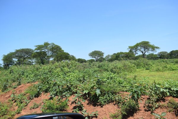
This stretch introduces you to Uganda’s open landscapes. The banana plantations give way progressively to drier, more open terrain. Then you enter Ankole — the land of long-horned cattle. The Ankole Longhorn cattle are unmistakable, their horns sometimes spanning over two meters. They graze in large herds beside the road, often attended by young herdsmen. The skies feel bigger here. The road is straight and fast. Mbarara at 270 kilometers is the standard lunch stop — allow 30 to 45 minutes. This is the last city-scale settlement before the highlands.
Mbarara to Ntungamo: 270 to 330 km
South of Mbarara the road continues through Ntungamo District. The landscape begins to change again — the open rangelands are replaced by more densely cultivated hillsides. Tea estates appear near Rubirizi. The hills start to fold into each other more dramatically. You are beginning the long climb toward the western highlands. Ntungamo town at roughly 330 kilometers is another option for a fuel stop.
Ntungamo to Kabale: 330 to 415 km
This is where the journey transforms. The road climbs steadily and the views expand. You pass through Rukiga District with its characteristic intensely terraced hillsides — every slope cultivated in neat horizontal bands of green. The air cools. Mist sometimes hangs in the valleys. The scale of the landscape is different from anything seen further north. Kabale appears in a bowl-shaped valley surrounded by hills. This is the “Switzerland of Africa” moment that every visitor has read about and it delivers. Kabale is 415 kilometers from Kampala — you are in the final section.
Kabale to Bwindi: 415 to 490 km
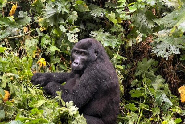
From Kabale the tarmac continues toward Buhoma via Butogota. At Butogota the road changes to red murram and the final 25 to 30 kilometers to the park gate is unpaved. Forest vegetation closes in around the track. The temperature drops noticeably. The sounds change — birdsong replaces road noise. Your vehicle climbs the last hill, rounds a corner, and Bwindi opens ahead. The canopy extends across the valleys below. Your lodge appears above the treeline. The journey is complete.
The Kampala to Bwindi road in 2027 is not just transport — it is the opening chapter of one of Africa’s great safari experiences. Every kilometer tells you something different about Uganda, and by the time you arrive you have read the whole introduction.
What do you see in the first section from Kampala to Masaka?
The Kampala to Masaka section covers approximately 135km and takes 2-2.5 hours depending on Kampala traffic. Leaving Kampala: the road south passes through Makindye and Ggaba Road areas before joining the main southward highway; Kampala traffic is densest 7-9am and 5-8pm; departing by 7am minimises delays. The equator crossing (Kayabwe): approximately 75km south of Kampala on the Masaka road; you cannot miss it — a large painted roadside installation marks the 0° latitude; most safari drivers stop here; souvenir sellers and the water-flow Coriolis demonstration are available; 10-15 minutes is enough time here. The road surface: the Kampala-Masaka highway is good quality tarmac; dual carriageway in sections; speed bumps in every trading centre slow progress; the trading centres of Lukaya and Mutukula junction are notable stops. The landscape: flat to gently rolling agricultural land; banana plantations are ubiquitous; papyrus swamps appear at low-lying sections — characteristic of the Lake Victoria basin.
What is the road like between Masaka and Mbarara and what can you see?
The Masaka to Mbarara section covers approximately 155km and takes about 2 hours on a good paved road. Masaka town: a significant Uganda town with a long main street of shops and services; this is the ideal lunch stop on a one-day drive; fuel up here as the next reliable fuel is Mbarara. The Lake Mburo turnoff: approximately 40km east of Masaka on the Mbarara road; the sign for Lake Mburo National Park indicates the detour; the lake itself is visible in the distance from the highway on a clear day. The Ankole landscape: from Masaka toward Mbarara, the terrain opens up into savannah-like grassland; this is Ankole district, home of the Banyankole people and their distinctive long-horned cattle; herds of Ankole cattle are a common sight roadside in this section. Mbarara town: the largest city in western Uganda; a full range of services including fuel, supermarkets, pharmacies, ATMs, and accommodation; the Mbarara ring road bypass avoids the centre.
What is the scenery like between Mbarara and Kabale?
The Mbarara to Kabale section of approximately 90km is the most visually dramatic paved section of the whole drive. The Ankole to Kigezi transition: leaving Mbarara the terrain is still relatively flat; approximately 30km south of Mbarara, the road begins to climb into the Great Rift Valley highlands; the landscape changes noticeably — hills become steeper, terracing appears, the vegetation becomes greener and more dense. The escarpment view: at the highest point before descending to Kabale, a panoramic view opens to the south and west; on a clear day you can see into the Democratic Republic of Congo; this is one of the finest views from a Uganda highway. Tea estates: the Kabale district has Uganda’s southernmost tea estates; the characteristic rows of green tea bushes appear on hillsides approaching Kabale; the altitude and cool temperatures of this zone support tea cultivation. Kabale town: approximately 35km from Bwindi Buhoma by road; the last major town; fill up on fuel, buy any remaining supplies here.
What is the final section from Kabale to Bwindi like and what should you prepare for?
The Kabale to Bwindi section is where the paved highway ends and the experience becomes distinctly more adventurous. Leaving Kabale: the paved road leaves Kabale northward toward Ntungamo or westward toward Rwanda; the Bwindi road branches off toward Kanungu; your driver will know the exact turn-off. The murram road surface: compacted red-earth laterite road; width for two vehicles to pass in places, single track in others; speed 30-50 kmh in dry season; significantly slower in wet season due to mud. The towns of Butogota and Kanungu: small trading centres on the route; basic fuel available at Kanungu if needed; this is also the point where you realise how remote Bwindi is. The forest appears: approximately 15km before Buhoma, the forest edge of Bwindi appears on the left side of the road; the tree canopy is dramatically tall — this is the edge of one of Africa’s most ancient forests; the drop in temperature is noticeable at this altitude (approximately 1,600 metres). Arrival at Buhoma: the Uganda Wildlife Authority gate at Buhoma is the formal entrance; lodges are within 1-3km of the gate; arrival in daylight is essential as per the no-night-driving rule.
What fuel, food, and supply stops should you plan on the Kampala to Bwindi drive?
The Kampala to Bwindi drive requires planned fuel and supply stops since services become very limited after Kabale. Fuel stops: fill up in Kampala before departure or at Masaka; fill again in Mbarara (the largest selection of fuel stations and the most reliable); fill in Kabale if your tank has dropped below half; carry a 20-litre fuel can for the Bwindi section as fuel between Kabale and Buhoma is available at Kanungu but not guaranteed to be in stock. Food stops: breakfast in Kampala before departure; lunch in Masaka (2.5 hours from Kampala); roadside market food (grilled maize, roasted groundnuts, bananas) available throughout; the Mbarara fast food strip has several restaurants. Water: buy bottled water in Kampala, Masaka, or Mbarara; do not drink from roadside water sources; lodges at Bwindi provide safe water. Mobile money/ATMs: Mbarara and Kabale both have ATMs; after Kabale, ATMs are absent; carry cash for tips, porters, and any local purchases at Bwindi.
- The Road to Bwindi: What You See on the 8-Hour Drive From Kampala
- Road transfer from Kampala to Bwindi: what to expect on the drive west
- Road transfers in Uganda: what to expect on the drive from Kampala to Bwindi
- Distance from Kampala to Bwindi: Drive Times and All Routes
- Best Stopovers on the Drive from Kampala to Bwindi: Where to Stop and What to See
- Entebbe to Bwindi by Road: The Scenic 8-Hour Drive Guide 2027
- Kampala to Bwindi by Private Car: What the Drive Really Looks Like 2027
- Mbarara Stopover: The Best Town to Break the Kampala to Bwindi Drive 2027
- Uganda’s roadside food: rolex, mandazi, and what to eat on the drive to Bwindi
- The road from Kabale to Bwindi: what to expect on Uganda’s most scenic drive