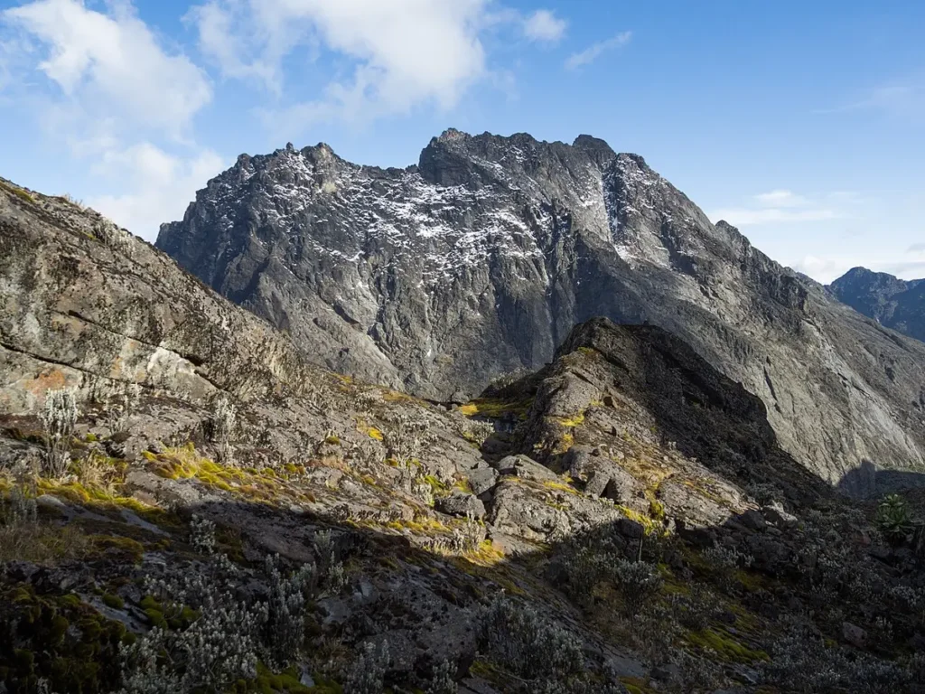
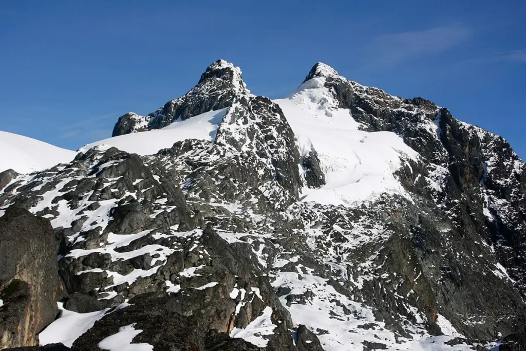
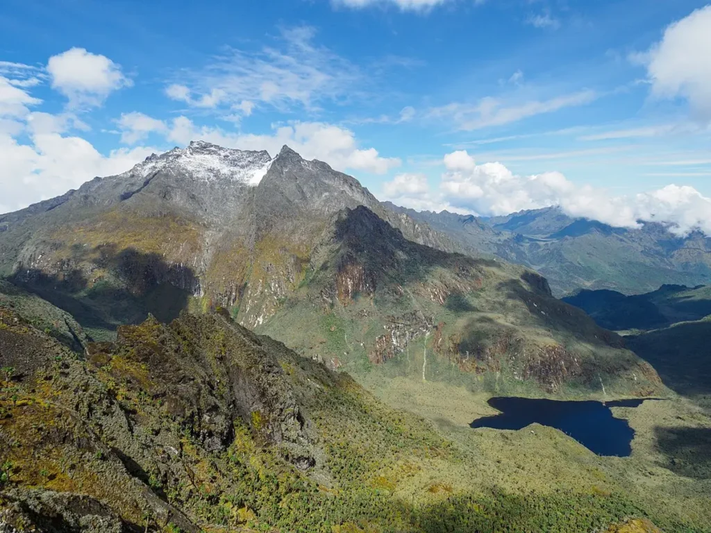
The Rwenzori Mountains rise from Uganda’s western border with the Democratic Republic of Congo to heights that carry permanent ice and snow on the equator — a geographical paradox that earned them the ancient name “Mountains of the Moon” attributed to Ptolemy’s second-century world geography, though the Rwenzoris were unknown to European geography until Henry Morton Stanley’s 1888 sighting of the permanently cloud-covered peaks and were not summited until Luigi Amadeo, Duke of the Abruzzi, reached the highest point in 1906 and named it Margherita Peak at 5,109 metres, the third highest point in Africa. The Rwenzoris are accessible from Kasese, near Bwindi gorilla trekking on the western Uganda circuit. See Uganda safari packages.
- Highest point: Margherita Peak, 5,109m (Mount Stanley massif); third highest point in Africa after Kilimanjaro and Mount Kenya
- UNESCO status: World Heritage Site since 1994
- Glaciers: the Rwenzoris retain equatorial glaciers but they are retreating rapidly; Speke Glacier, Elena Glacier, and others are measurably smaller than in early surveys
- Main trekking circuit: the Central Circuit; 8-10 days; requires guides and porters via Rwenzori Mountaineering Services (RMS); high technical difficulty above the hut system
- Access town: Kasese (approximately 5 hours from Fort Portal / Kibale; 6-7 hours from Bwindi Buhoma)
The Rwenzori Mountains rise from Uganda’s western border with the Democratic Republic of Congo, their highest peaks permanently ice-capped despite sitting on the equator — a geological anomaly that earned them the ancient name Mountains of the Moon. Margherita Peak on Mount Stanley, the highest point in the range at 5,109 metres, is the third-highest peak in Africa, and the Rwenzori range is one of only three places on the African continent where glaciers persist at equatorial latitudes. For visitors to Uganda who have completed their gorilla trek at Bwindi and are looking for the next extraordinary natural experience within driving distance, the Rwenzori Mountains represent one of Africa’s most otherworldly and least-visited mountain environments.
The otherworldly vegetation zones of the Rwenzoris
The Rwenzori Mountains are most famous among botanists and serious trekkers for their extraordinary high-altitude vegetation zones, which produce landscape imagery unlike anything found elsewhere in Africa or arguably anywhere on earth. The Afro-alpine vegetation zone that dominates the slopes above 3,500 metres contains giant versions of plant genera that elsewhere grow at modest sizes: giant groundsels (Senecio) with trunks two metres tall topped by rosettes of cabbage-sized leaves, giant lobelias that stand three to four metres high in forests of their own kind, giant heathers with trunks twenty centimetres thick draped in moss and lichen that give the forest a spectral, primeval appearance unlike any forest found at lower altitudes.
This gigantism phenomenon — technically known as high-altitude gigantism — occurs in several equatorial mountain environments worldwide, including the Andes and Hawaii, but reaches its most extreme expression in the Rwenzoris. The specific combination of equatorial light, extreme diurnal temperature variation, high rainfall, and cloud cover that the Rwenzori peaks experience appears to favour the growth strategies that produce giant forms, and the result is a botanical spectacle that trekkers consistently describe as one of the most extraordinary natural environments they have ever visited, comparable in its impact to the encounter with gorillas themselves.
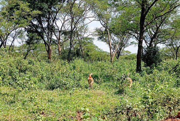
The lower zones of the Rwenzori support humid montane forest similar in character to Bwindi, with rich bird and mammal communities including chimpanzees, colobus monkeys, and numerous bird species shared with the Bwindi ecosystem. The forest zone transitions through heather forest and bamboo belt to the open Afro-alpine zone, creating a complete altitudinal sequence of East African montane vegetation that can be experienced within a single multi-day trek from the base to the high-altitude zones.
Trekking options: day walks to multi-day summit circuits
Rwenzori Mountains National Park offers trekking options ranging from single-day forest walks from the park entrance at Nyakalengija to the full Central Circuit, a seven to eight day route that reaches the glacier zone and provides access to Margherita Peak for climbers with technical mountaineering skills and equipment. Most leisure visitors choose the three to four day lower-altitude circuit that reaches the spectacular giant vegetation zones without requiring glacier travel or technical climbing, combining challenging but achievable trekking with landscapes that fully justify the physical investment.
The Rwenzori trekking experience is more technically demanding than gorilla trekking and requires a different level of preparation and equipment. The trails are genuinely remote, rainfall is frequent throughout the year — the Rwenzoris are among the wettest places in Africa — and the muddy, root-covered paths in the forest zone are as challenging as Bwindi’s trails. Above the treeline, the terrain opens into the otherworldly Afro-alpine zone, but the elevation and weather exposure introduce factors that require proper mountain clothing and equipment. Most trekkers use the services of Uganda Mountain Guides, the organisation that supplies and trains guides and porters for Rwenzori treks, whose support infrastructure makes the experience accessible to reasonably fit visitors without mountaineering backgrounds.
Day walks from Nyakalengija into the lower forest zone are available for visitors who want to experience the Rwenzori’s forest ecology without committing to a multi-day circuit. These walks reach impressive forest with good bird and mammal diversity and provide a sense of the mountain environment without the full logistical commitment of an overnight trek. For visitors combining Rwenzori with a Bwindi gorilla trekking itinerary who have a day to spare in the Kasese area — through which the road from Kampala to Bwindi passes — a forest day walk is a worthwhile addition that adds another dimension to the mountain ecosystem experience.
Glaciers and climate change: a disappearing resource
The Rwenzori glaciers are retreating at an accelerating rate due to climate change. Scientific studies have documented a reduction in total glacier area of approximately 80 percent since the first systematic measurements were made in the early twentieth century. The remaining glaciers — covering approximately two square kilometres at the time of the most recent survey — are projected to disappear entirely within decades under current warming trajectories, ending the equatorial ice cap that has existed through multiple glacial cycles over tens of thousands of years.
The disappearance of Rwenzori glaciers would eliminate not only a dramatic visual feature but also an important water source for the rivers that flow from the mountains into Lake Edward and the Congo drainage system. Communities in the valleys below the Rwenzoris depend on the regulated water supply that glacial meltwater contributes to seasonal river flows, and the loss of this regulation will affect agricultural water security in ways that are difficult to fully predict but are likely to be significant.
For visitors, the awareness that the Rwenzori glaciers are a disappearing feature adds urgency to the experience of seeing them. The combination of gorilla conservation at Bwindi — where a population has been brought back from the brink through human commitment — and glacier loss at the Rwenzoris — where the trajectory is currently irreversible without global-scale action on climate change — captures the full spectrum of humanity’s relationship to the natural world: the extraordinary success of targeted conservation, and the humbling scale of the challenge that systemic environmental change poses. This contrast, experienced within a single Uganda itinerary, is one of the most thought-provoking aspects of visiting this extraordinary region.
What makes the Rwenzori Mountains ecologically unique?
The Rwenzori Mountains are home to an afroalpine ecosystem found at high altitudes throughout the East African mountains — but the Rwenzoris develop it to an extreme degree that distinguishes them from Kilimanjaro and Kenya. Giant lobelias (Lobelia wollastonii and others) grow to 10 metres tall, with massive cylindrical flower stalks; tree heathers (Erica arborea and Philippia) grow to 8-10 metres and are festooned with moss; giant groundsels (Dendrosenecio adnivalis, called senecios locally) grow as tree-like rosettes to 8 metres on the moorland and glacier approach slopes. The combination of these three giant afroalpine plants in the zone between approximately 3,400m and 4,200m produces a landscape that appears genuinely alien to most visitors — a moonscape of grotesque, enormous plants adapted to the cold, UV-intense environment of an equatorial high altitude. The Rwenzoris receive exceptional rainfall (3,000-4,000mm per year in the moist lower zones) and are cloud-covered for most of the year, giving the vegetation the dense, dripping, primeval quality that makes trekking here a different aesthetic experience from any other African mountain. UNESCO cited the Rwenzoris’ ecological uniqueness as the primary reason for World Heritage designation in 1994.
How hard is the Rwenzori trek and who can attempt it?
The Rwenzori central circuit trekking is among the most physically and technically demanding multi-day treks in Africa. The lower elevation sections (1,600-3,400m) involve steep, wet forest trails with substantial mud and root obstacles that require good fitness and waterproof equipment. The upper sections (3,400-4,500m) involve moorland and rocky terrain in frequently wet and cold conditions. The summit approach to Margherita Peak (5,109m) on Mount Stanley requires glacier travel with ropes, crampons, ice axes, and guide expertise — it is a technical mountaineering objective, not a standard hiking destination. The standard Central Circuit (Kilembe route) to the high hut area without summit climbing is achievable by fit, experienced trekkers with good mountain fitness. A shorter, 3-day lower-elevation trek is available for visitors who want the Rwenzori afroalpine forest experience without the full circuit commitment. The Rwenzori Mountaineering Services (RMS) provides all guides, porters, and hut accommodation for the circuit; no independent trekking is permitted. Physical requirement for the full circuit: substantially higher fitness level than gorilla trekking; comparable to a Kilimanjaro summit attempt in terms of altitude and duration demands.
Are the Rwenzori glaciers disappearing and what does this mean?
The Rwenzori glaciers are retreating rapidly and are among the most visibly affected tropical glaciers in the world. Historical surveys from the early 20th century documented a glacier system covering approximately 7 km² across six main glaciers on the Rwenzori summits. By 2020, the glacier coverage had reduced to approximately 0.5 km² — a reduction of over 90% since the first surveys. The specific glaciers on Mount Stanley (Elena, Albert, Stanley, Coronation glaciers) and Mount Speke (Speke Glacier) are all substantially smaller than historical records show. Climate modelling suggests that the Rwenzori glaciers could disappear entirely within decades if current warming rates continue — the same trajectory documented on Kilimanjaro and Mount Kenya, which have both lost the majority of their historical glacier coverage. What this means for Uganda: the Rwenzori glaciers are a freshwater store; their loss will affect the hydrology of the Semliki River system and Lake Albert catchment, though the magnitude of this effect on a regional scale is modest compared to the symbolic loss of equatorial glaciers and the ecological loss to the specific high-altitude ecosystems that depend on snowmelt water.
Can I visit the Rwenzori as a day trip or short excursion?
Short Rwenzori excursions are available and worthwhile for visitors who cannot commit to the full multi-day circuit. The Kilembe Trails visitor centre, operated by RMS near Kasese, offers day hikes of 4-6 hours that enter the lower forest zone of the Rwenzoris without reaching the afroalpine vegetation above the treeline — but the lower forest itself has excellent birding (Rwenzori turaco, Rwenzori batis, Stuhlmann’s double-collared sunbird, and several other Albertine Rift endemics) and the forest character at these lower elevations is distinctive and beautiful. A one-night option using the lower hut system takes you to approximately 2,700m — into the top of the montane forest and the beginning of the transition to giant heather zone — in a way that a single day hike does not reach. For visitors combining the western circuit (Kibale-QENP-Bwindi), a half-day Rwenzori excursion from Kasese — which sits between QENP and the Kibale/Fort Portal area — is a practical addition to the itinerary without requiring additional nights. Confirm the current Kilembe Trails programme with your operator; the RMS arrangements have changed in recent years.
What birds are endemic to the Rwenzori Mountains?
The Rwenzori Mountains are in the Albertine Rift biodiversity hotspot, which has the highest concentration of endemic birds of any area in Africa. The Rwenzori-specific and Albertine Rift endemics found here include: the Rwenzori turaco (Gallirex johnstoni) — a brilliant green and red turaco found only in the Rwenzori and Virunga mountain forests; Rwenzori nightjar (Caprimulgus ruwenzorii); Stuhlmann’s double-collared sunbird; Rwenzori batis (Batis diops); Archer’s robin-chat; African green broadbill (Pseudocalyptomena graueri) — one of Africa’s rarest broadbills, found in the Rwenzori and Itombwe Massif in DRC; the strange weaver (Ploceus alienus); and handsome francolin. Total Rwenzori bird list: approximately 217 species, of which 19 are Albertine Rift endemics found nowhere else in the world. For birders, the Rwenzori lower forest zone (1,600-2,600m) is one of the most significant endemic-seeking sites in Africa, producing species that cannot be found reliably at any other Uganda location.
- The Rwenzori Mountains and the Mountains of the Moon: their place in African exploration history
- Rwenzori Mountains Uganda: Trekking the Mountains of the Moon
- The Rwenzori Mountains: Africa’s Glaciers You Have Never Heard Of
- The Rwenzori Mountains: mythology, exploration, and the Mountains of the Moon
- Gorilla Trekking Uganda for Hikers: Combine Bwindi With the Rwenzori Mountains
- Rwenzori Mountains and gorilla trekking: combining two of Uganda’s great adventures
- 20 Fun Facts About Mountains (So Fascinating)
- The Only Spanish-Speaking Country in Africa
- Virunga Mountains: The Volcanic Range That Shaped Gorilla Evolution
- Why Uganda Is the Most Biodiverse Country in Africa Per Square Kilometre