Updated
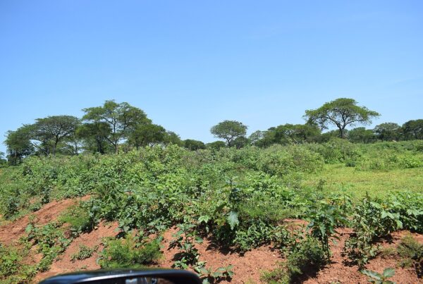
Kigezi Uganda highlands gorillas is a subject central to Uganda’s wildlife tourism, where mountain gorilla conservation and responsible visitor experiences go hand in hand. The comparison gets made so frequently by visitors that it has become almost a cliche: arriving in Kigezi, in Uganda’s far southwest, people reach for the same reference point. The terraced hills, the cool highland air, the neat patchwork of small farms climbing impossibly steep slopes, the mist that hangs in the valleys in the morning — it looks like Switzerland. Or like the Dolomites, or the Basque Country, or any of the high, intensively farmed mountain landscapes of Europe that provide the mental vocabulary for mountain beauty in the minds of most international travellers.
The comparison is superficially apt and fundamentally misleading. Kigezi is not like Switzerland except in the most visual and superficial sense. Its history, ecology, social organisation, and current challenges are entirely its own — products of a specific place at a specific latitude with a specific human population that has been farming these hills for longer than most European alpine regions have been inhabited at all. But the comparison has stuck, and it serves a useful purpose: it signals to people who have never considered Uganda as a destination that what they will find in the southwest is not the flat African savanna of their imagination but something genuinely different and, in its own way, magnificent.
Kigezi: The Switzerland of Africa Where the Gorillas Live
The Geography of the Kigezi Highlands
The Kigezi region — sometimes called Kigezi or the Kigezi Highlands, administratively divided into the districts of Kabale, Kisoro, Rukungiri, and Kanungu — occupies the southwestern corner of Uganda where the country meets Rwanda and the DRC. It sits on the edge of the Albertine Rift, the western branch of the East African Rift Valley, and the collision between the ancient basement rocks of the African plateau and the younger volcanic activity of the Virunga chain creates a landscape of exceptional diversity.
The elevation ranges from around 1,200 metres at lower valley floors to over 4,000 metres on the summit ridges of the Virunga volcanoes in the south. The rainfall is high and reliable — Kigezi receives precipitation throughout most of the year, with two distinct wet seasons that allow two agricultural cycles annually. The temperatures are cool by Ugandan standards — daytime maxima in Kabale rarely exceed 22 degrees Celsius, and nights can be cold enough to require blankets.
The Terracing System
The most visually striking feature of the Kigezi landscape is its terracing. Every cultivable slope — and in Kigezi, cultivable means nearly every slope up to extreme angles — has been reshaped by generations of farming families into the horizontal bench terraces that control erosion, retain moisture, and allow cultivation of crops that would wash away on unmodified hillsides. The terracing system is not the result of any external agricultural development programme; it is the accumulated work of generations of Bakiga farmers, developed and refined over centuries in response to the fundamental challenge of feeding a dense population on steep terrain.
The Bakiga — whose name means “people of the mountains” — developed one of the most sophisticated hillside farming systems in sub-Saharan Africa. The terrace system is integrated with water management (channels direct rainfall away from terraces to prevent erosion while retaining enough for crop growth), crop rotation (different crops in adjacent terraces minimise pest and disease pressure), and soil management (the terraces trap organic matter and prevent the soil degradation that afflicts unmanaged slopes). The beauty visitors admire is the visual expression of a practical intelligence developed under genuine constraint.
Where the Gorillas Live
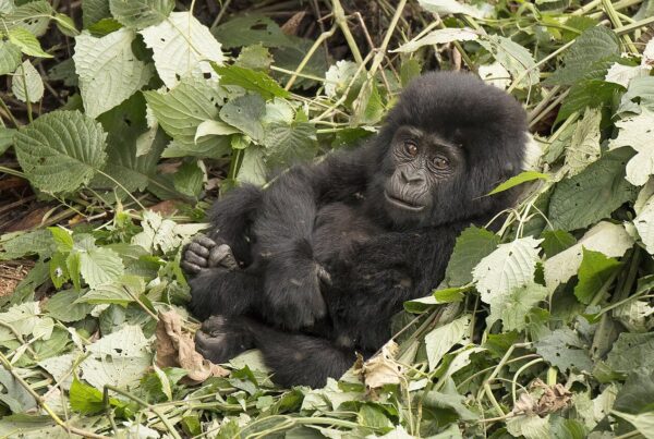
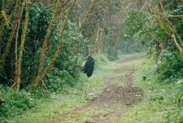
Bwindi Impenetrable National Park and Mgahinga Gorilla National Park — the two reserves that together protect approximately half of the world’s remaining mountain gorilla population — are both located in the Kigezi region. Bwindi’s four sectors (Buhoma, Ruhija, Rushaga, and Nkuringo) are scattered across the rugged terrain of Kanungu and Kabale districts. Mgahinga sits on the lower slopes of the Virunga volcanoes in Kisoro district, sharing its gorilla population with Rwanda’s Volcanoes National Park and the DRC’s Virunga National Park.
The gorillas’ choice of habitat is not coincidental. The Albertine Rift forests of the Kigezi region represent one of the most biodiverse ecosystems in Africa — a consequence of the region’s altitude, rainfall, geological diversity, and position at the intersection of several distinct biogeographical zones. Mountain gorillas require exactly the kind of diverse, productive forest that the Kigezi highlands provide: multiple vegetation layers, year-round water availability, and a wide diversity of food plant species that allow dietary variety across seasons.
The Altitude Advantage
The cool temperatures of the Kigezi highlands are, paradoxically, one of the factors that make gorilla trekking here more comfortable than the lowland forest experiences offered in some other primate habitats. Trekking at altitude in cool air is less taxing than equivalent exertion in lowland humidity. The mist that visitors sometimes curse for reducing visibility actually moderates temperature and contributes to the atmospheric quality that makes Bwindi feel genuinely primordial — a forest that exists outside normal time and normal climate.
Lake Mutanda and Lake Bunyonyi
The Kigezi highlands contain several spectacular lakes that form natural resting points before or after gorilla trekking. Lake Bunyonyi, near Kabale, is one of the most beautiful lakes in Africa — a deep, island-studded crater lake surrounded by terraced hills, safe for swimming, and dotted with small guesthouses and lodges that offer some of the most serene accommodation in Uganda. Lake Mutanda, near Kisoro, provides dramatic views of the Virunga volcanoes across its surface and is the location of several luxury lodges that have positioned themselves as premium gorilla trekking bases.
These lakes are not incidental scenic additions to a gorilla itinerary. They are integral parts of the Kigezi landscape — geological features that define the drainage system, moderate the local climate, and provide resources for the communities living on their shores. The traditional fishing communities of Lake Bunyonyi have maintained distinctive social organisations and material cultures shaped by the lake’s specific constraints and opportunities. Their history is as interesting, in its own way, as the mountain gorilla’s.
The Food of Kigezi
The highland climate and volcanic soils of Kigezi produce food that differs noticeably from the cuisine of Uganda’s lowlands. Irish potatoes — grown at altitude, where the cool temperatures and well-drained soils produce tubers of exceptional density and flavour — are the dietary staple here rather than the matooke bananas that dominate lower Uganda. Sorghum and millet, which thrive in the high, cool conditions, are used for local beer brewing and in traditional porridges.
The highland vegetables — cabbages, kale, onions, carrots, and various leafy greens — grow with extraordinary quality in Kigezi’s soils. The markets in Kabale and Kisoro carry produce that chefs in Kampala’s best restaurants seek out specifically, aware that the highland origin means superior flavour and texture. For visitors who take their meals in local restaurants rather than exclusively at lodge dining rooms, the food of Kigezi is one of the region’s less-celebrated but genuinely distinctive pleasures.
The Switzerland That Is Itself
The Switzerland comparison ultimately fails, and not because Kigezi is less beautiful. It fails because Switzerland is the reference point of a travel imagination that knows Europe well and Africa less well — that reaches for the familiar when confronted with the unfamiliar. Kigezi does not need to be like Switzerland to be worthy of the attention it receives. It is worthy of attention because it is itself: a highland landscape of extraordinary beauty and biological richness, shaped by centuries of human intelligence and adaptation, containing the largest population of mountain gorillas in the world, and offering, at $800 per permit in 2027, one of the most extraordinary wildlife experiences available anywhere on Earth. That is worth a different kind of superlative — one that does not require the comparison to be made at all.