Updated
Virunga Mountains: The Volcanic Range That Shaped Gorilla Evolution
Virunga Mountains: The Volcanic Range That Shaped Gorilla Evolution
Virunga Mountains gorilla habitat is a subject central to Uganda’s wildlife tourism, where mountain gorilla conservation and responsible visitor experiences go hand in hand. The Virunga Mountains are one of Africa’s most dramatic and biologically significant landscapes. This chain of eight volcanoes — spanning the border zones of Uganda, Rwanda, and the Democratic Republic of Congo — rises from the Great Rift Valley floor to heights exceeding 4,500 metres and forms the core habitat of the Virunga mountain gorilla population. The volcanoes are geologically young and still active, with two of the eight having erupted in the 21st century. Understanding the Virungas’ geology, ecology, and conservation significance enriches the experience of gorilla trekking at Mgahinga in Uganda, Volcanoes National Park in Rwanda, or Virunga National Park in the DRC.
The Eight Volcanoes
The Virunga chain consists of eight volcanoes arranged in a roughly northwest-to-southeast arc along the Albertine Rift. From northwest to southeast: Mikeno (4,437m, DRC — extinct), Karisimbi (4,507m, Rwanda/DRC border — dormant), Bisoke (3,711m, Rwanda/DRC border — active), Muhabura (4,127m, Uganda/Rwanda border), Gahinga (3,474m, Uganda/Rwanda border), Sabinyo (3,634m, Uganda/Rwanda/DRC triple border), Nyiragongo (3,470m, DRC — highly active), and Nyamuragira (3,058m, DRC — Africa’s most active volcano). Of these eight, only the first six fall within the mountain gorilla habitat zone. Nyiragongo and Nyamuragira are active shield and stratovolcanoes in the DRC whose lava flows occasionally threaten the city of Goma.
Geological Formation
The Virunga volcanoes formed as part of the rifting process that has been reshaping the African plate for millions of years. As the continental crust stretches and thins along the Albertine Rift, magma rises through fractures to form volcanic centres. The Virungas are relatively young geologically — most of the visible volcanic structures formed within the past two million years — and the region remains seismically and volcanically active. The volcanic soils of the Virunga foothills are exceptionally fertile, supporting dense human populations in the surrounding agricultural zones of Rwanda, Uganda, and DRC and creating intense pressure on the remaining natural habitat.
The Virunga Ecosystem
The Virunga volcanoes are protected across three countries by three national parks: Mgahinga Gorilla National Park (Uganda), Volcanoes National Park (Rwanda), and Virunga National Park (DRC). Together these three parks protect approximately 790 square kilometres of mountain gorilla habitat, of which Virunga National Park is by far the largest component at approximately 600 square kilometres. The parks share a continuous forest block that allows gorilla groups to range freely across national boundaries — a transboundary dynamic that requires coordinated management by three different national conservation authorities.
Vegetation Zones
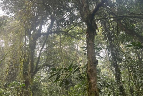
The Virunga volcanoes support distinct vegetation zones at different elevations. The lower slopes below 2,000 metres are largely cleared for agriculture and settlement, with the natural vegetation reduced to isolated patches. From 2,000 to 2,500 metres, a zone of Hagenia woodland and mixed montane forest constitutes the main gorilla habitat. Above 2,500 metres, bamboo zones cover large areas of the volcanic slopes, providing critical seasonal food for gorillas. Higher still, above 3,000 metres, the vegetation transitions to giant heather (Erica arborea) and moorland before giving way to the bare volcanic rock and occasional lava flows of the upper peaks. Gorillas typically use the forest and bamboo zones but rarely venture above the heather belt.
Mountain Gorillas in the Virungas
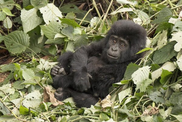
The Virunga mountain gorillas (Gorilla beringei beringei) represent one of two mountain gorilla populations — the other being the Bwindi population in Uganda. The Virunga population is monitored continuously by researchers from the Dian Fossey Gorilla Fund, Mountain Gorilla Veterinary Project, and national park authorities. Multiple gorilla families in the Virungas are habituated for research or tourism, with tourism-habituated groups accessible from Rwanda’s Volcanoes National Park and Uganda’s Mgahinga. The Virunga population now numbers approximately 600 individuals, with additional gorillas in the Bwindi population bringing the global mountain gorilla count above 1,000 for the first time in recorded history.
The Nyakagezi Group at Mgahinga
Uganda’s Mgahinga Gorilla National Park is home to the Nyakagezi gorilla family — the only habituated group in the park. The Nyakagezi group typically contains 10 to 12 individuals including multiple silverbacks, females, juveniles, and infants. The group’s home range spans all three of the Ugandan Virunga volcanoes — Muhabura, Gahinga, and Sabinyo — and occasionally crosses into Rwanda or DRC when following seasonal food resources. This transboundary movement means that on any given day the group may be located anywhere within their extensive range, which can make for a long and strenuous trek when they are deep in the forest or high on the volcanic slopes.
Climbing the Virunga Volcanoes
Visitors to Mgahinga have the option to climb the Ugandan Virunga volcanoes as part of their experience. Mount Sabinyo (3,634m), which sits at the triple border of Uganda, Rwanda, and DRC, offers the most popular climb — a challenging but achievable full-day hike that passes through forest, bamboo, and heather zones before reaching three summits connected by knife-edge ridges. From the top, on clear days, all three countries are visible. Mount Muhabura (4,127m) is the tallest of Uganda’s Virungas and requires a full day’s climb through varied vegetation zones to reach its crater lake summit. Mount Gahinga (3,474m) is the easiest of the three and famous for its swamp-filled crater at the top. Climbing permits are purchased separately from gorilla trekking permits at Uganda Wildlife Authority.
Golden Monkey Trekking in the Virungas
The Virunga bamboo zones also harbour golden monkeys (Cercopithecus kandti), an Albertine Rift endemic and one of Africa’s most visually striking primates. Golden monkeys have a vivid golden-orange patch on their backs contrasting with black limbs and face — making them among the most photogenic primates in Africa. A habituated golden monkey group in Mgahinga allows close viewing of these energetic and playful primates. Golden monkey trekking permits cost USD 60 per person and can be combined with gorilla trekking for a full Mgahinga wildlife day. The bamboo zones where golden monkeys live are also excellent for birding, with species associated with bamboo thickets found here reliably.
The DRC: Virunga National Park
Virunga National Park in the DRC is Africa’s oldest national park, established in 1925 by the Belgian colonial administration. The park extends far beyond the gorilla habitat zone to include the rift valley lakes, savanna, and lowland forests of eastern DRC. The park’s conservation history has been one of the most dramatic and heroic in Africa, with rangers facing sustained armed conflict during the DRC’s decades of civil war. Numerous rangers have been killed protecting the park’s wildlife. Gorilla trekking in Virunga National Park was suspended for extended periods due to insecurity and was not operating at the time of writing. Travellers interested in the DRC mountain gorillas should monitor security situations and official travel advisories carefully before planning any visit.
Transboundary Conservation
The governance challenge of protecting mountain gorillas that range freely across three international boundaries is one of conservation’s most complex problems. The International Gorilla Conservation Programme (IGCP), a coalition of WWF, African Wildlife Foundation, and Flora and Fauna International, has worked for decades to facilitate coordination between Uganda, Rwanda, and DRC national park authorities. The Greater Virunga Transboundary Collaboration (GVTC) is the formal mechanism for joint management planning, anti-poaching coordination, and tourism revenue sharing across the three countries. This collaboration has been remarkably successful given the political instability and conflict that has affected the region — a testament to the commitment of rangers, researchers, and conservation managers across all three countries who work daily to protect this extraordinary ecosystem.