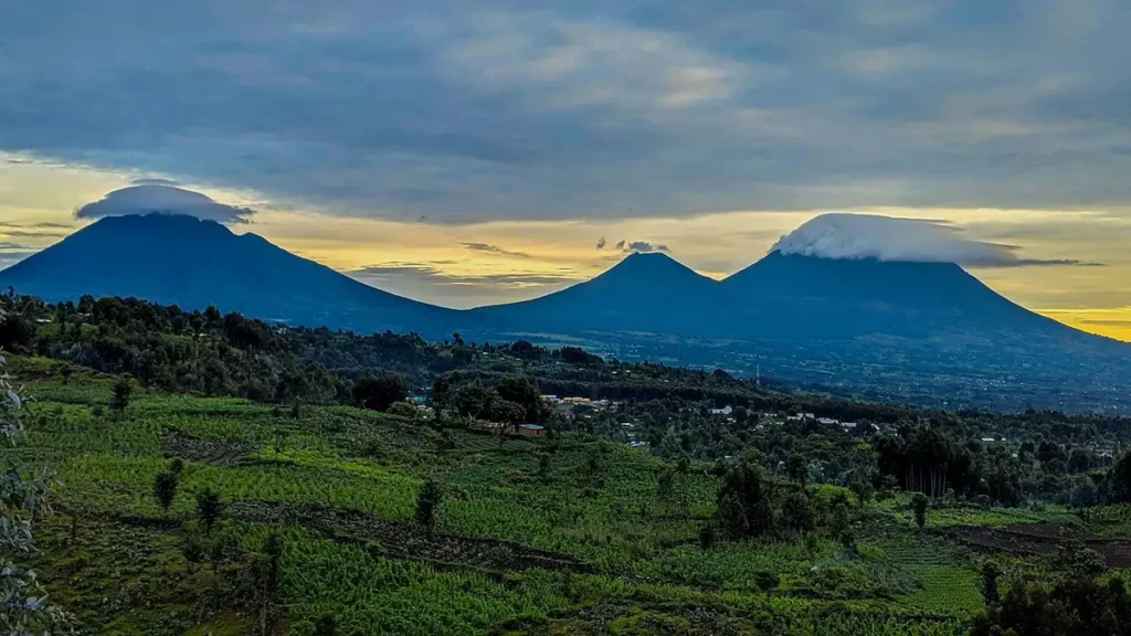
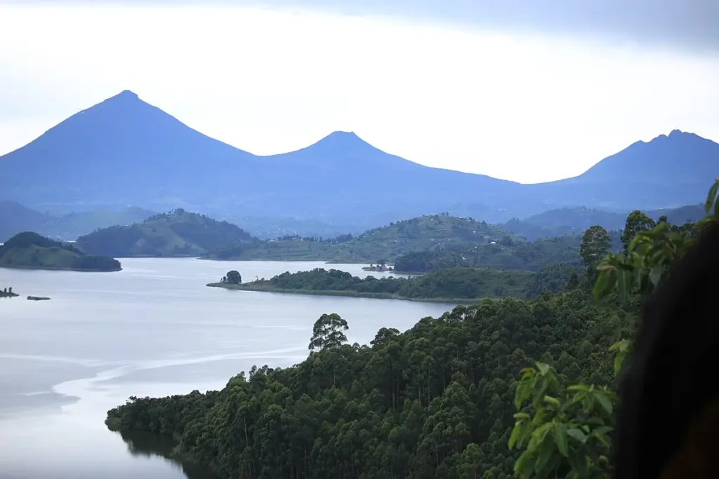
The Virunga volcanoes — eight volcanic peaks straddling the borders of Uganda, Rwanda, and the Democratic Republic of Congo — are among the most geologically active landscapes in Africa and among the most important wildlife habitats on earth: they are the reason mountain gorillas exist at altitude, the formation that created the montane forest ecosystem the subspecies evolved in, and the source of the fertile soils that have made the surrounding region both extraordinarily productive for human agriculture and extraordinarily difficult to protect as wildlife habitat. Three of the eight Virunga volcanoes — Sabinyo, Gahinga, and Muhavura — are in Uganda, reachable from Mgahinga Gorilla National Park as climbing targets for visitors who have completed their gorilla trek. See Uganda safari packages.
- Number of peaks: 8 — spanning Uganda (3), Rwanda (3), DRC (2)
- Highest peak: Mt. Karisimbi, 4,507m (Rwanda/DRC border)
- Active volcanoes: Nyiragongo (DRC) — erupted most recently in May 2021; Nyamuragira (DRC)
- Uganda Virungas: Mt. Sabinyo (3,669m), Mt. Gahinga (3,474m), Mt. Muhavura (4,127m)
- Gorilla history: Robert von Beringe first described mountain gorillas on Mt. Sabinyo in 1902; Dian Fossey’s Karisoke research centre was on Mt. Karisimbi
The Virunga volcanoes — eight volcanic peaks straddling the borders of Uganda, Rwanda, and the Democratic Republic of Congo — are among the most geologically active landscapes in Africa and among the most important wildlife habitats on earth. They are the reason mountain gorillas exist where they do: the volcanic peaks and their associated montane forests created the specific combination of altitude, climate, and ecological conditions that drove the evolution of the mountain gorilla as a distinct subspecies. Understanding the geology and history of the Virungas provides essential context for understanding the gorillas that live on them.
The geology of volcanic activity
The Virunga Massif sits at the intersection of two major fault systems in the western branch of the East African Rift Valley. The rifting process — continental plates pulling apart — creates zones of crustal weakness through which magma from the underlying mantle can rise. The Virunga volcanoes represent eight distinct points along this fault system where magma has erupted repeatedly over the past several million years, building the volcanic peaks from the rift valley floor.
The eight volcanoes range from dormant to very active. Nyiragongo, in the DRC, is one of the world’s most active volcanoes — a massive lava lake has occupied its crater summit almost continuously for decades, occasionally producing catastrophic lava flows that have reached the city of Goma at its base. The 2002 eruption sent lava flows through Goma, destroying much of the city and creating a humanitarian crisis. Another major eruption in 2021 again caused evacuations. Nyamuragira, near Nyiragongo, is Africa’s most historically active volcano with numerous eruptions recorded.
The Ugandan peaks — Muhavura (4,127m), Gahinga (3,474m), and Sabinyo (3,645m) — are extinct, with no recorded eruptions in historical time. Their geological quietude makes them safer destinations for the gorillas and for visitors than the more active peaks to the south and west. The Rwanda peaks — Karisimbi (4,507m), the highest, and Bisoke (3,711m) — are dormant, with the last eruptions occurring thousands of years ago. The three peaks that make up the bulk of Volcanoes National Park’s gorilla habitat — Karisimbi, Bisoke, and Sabyinyo — are the core of Rwanda’s gorilla country.
How the volcanoes created gorilla habitat
The volcanic peaks are important to mountain gorilla evolution not because of volcanic activity but because of the altitude and isolation they create. The Virunga peaks rise from the rift valley floor at approximately 900 metres elevation to over 4,500 metres at Karisimbi’s summit. This dramatic altitudinal range creates a compressed ecological gradient — the lower slopes are warm and tropical; the middle elevation zones (1,500–3,000m) are where the montane forest occurs that provides gorilla habitat; the upper slopes are afroalpine heath and moorland too cold and exposed for gorillas.
The montane forest zone on the Virunga slopes is relatively isolated from similar habitats by the warmer, drier lowlands of the rift valley floor. This isolation created conditions favouring localised evolution — populations adapting to the specific conditions of their mountain environment over generations without gene flow from lowland populations. The mountain gorilla’s longer, denser fur (an adaptation to cool mountain nights), shorter arms relative to body size (reflecting a more terrestrial lifestyle than the arboreal orangutan or chimpanzee), and different dietary preferences from its lowland relatives are all adaptations that evolved in response to the specific selective pressures of the Virunga and Bwindi highland environments.
Karisoke: where mountain gorilla science began
The name Karisoke is a portmanteau of two volcano names — Karisimbi and Bisoke — between which Dian Fossey established her research camp in 1967. The Karisoke Research Centre, still operating today under the management of the Dian Fossey Gorilla Fund International, has been the primary long-term research site for mountain gorilla behavioural ecology, social structure, and population dynamics since its founding. The data collected at Karisoke over nearly six decades represents an extraordinary scientific archive — one of the longest continuous behavioural datasets for any wild primate population.
Fossey’s decision to establish the camp on the saddle between two volcanoes was deliberate: the saddle area, at approximately 3,000 metres elevation, offered relatively flat terrain within the gorilla’s prime habitat zone. The cold, mist-shrouded conditions she described in “Gorillas in the Mist” are characteristic of the upper montane forest zone — conditions that most visitors today find challenging but that Fossey spent years enduring in primitive conditions by contemporary standards.
The research conducted at Karisoke and its successor operations established the foundational knowledge that underpins all gorilla conservation: the social structure of gorilla groups, the habituation protocol, the key causes of mortality, the ranges and movement patterns that define habitat requirements, and the individual identification systems that track specific gorillas across their lifetimes. Without Karisoke, the conservation programme that has produced the population recovery would not have had the scientific foundation to operate effectively.
Climbing the Ugandan Virungas
At Mgahinga Gorilla National Park, two of the three Ugandan Virunga peaks are climbable by visitors on guided day hikes. Mount Sabinyo (3,645m) is the most challenging — the climb involves a series of ridge sections including some requiring ladder climbing near the summit, and the summit itself straddles the triple point where Uganda, Rwanda, and the DRC meet. Mount Gahinga (3,474m) is a gentler ascent through bamboo and giant lobelia vegetation to a crater summit containing a small crater lake. Both climbs are managed by Mgahinga’s ranger staff and require a permit.
The views from these summits on clear days are extraordinary: the entire Virunga chain visible to south and southwest, Lake Edward and the DRC lowlands to the northwest, and the green hills of Rwanda’s Musanze plateau to the south. The altitude produces a physical sensation — thin air, vivid light, the exposure of a high place — that the forest walks do not. Combining a gorilla trek or golden monkey experience at Mgahinga with a volcano climb creates a day of contrasts (underground darkness and immense altitude) that captures the park’s full range in a single visit.
The volcanoes and the gorillas’ future
The volcanic landscape that created gorilla habitat also constrains it. The finite area of suitable montane forest on the Virunga peaks — surrounded by the rift valley lowlands on all sides — means that the mountain gorilla population cannot expand beyond the current habitat. Any reduction in forest area, whether from agricultural encroachment at the lower boundary or from climate-driven upslope compression of the habitat zone, directly reduces the carrying capacity available to the gorilla population. The volcanoes are both the gorillas’ home and their limiting factor — a geography that makes conservation of the existing habitat non-negotiable.
How did the Virunga volcanoes form and why do they support gorilla habitat?
The Virunga volcanic chain was formed by the same geologic process that created the entire Albertine Rift system: the East African Rift, where the African tectonic plate is slowly splitting apart. As the crust thins and rifts apart, magma rises through the fractured rock, creating a chain of active and dormant volcanoes along the rift margins. The Virunglas sit at the intersection of the Albertine Rift with a regional hot spot of elevated geological activity, which is why two of the range’s peaks — Nyiragongo and Nyamuragira in the DRC — remain actively volcanic while the others are dormant. The volcanoes create gorilla habitat by lifting terrain to elevations where montane forest develops — the characteristic cool, mist-laden forest of the Afromontane zone that mountain gorillas evolved in. The volcanic soils are extraordinarily fertile, producing the dense, diverse plant growth that provides the gorilla’s food supply.
Which Virunga peaks are in Uganda and can visitors climb them?
Three Virunga peaks fall within Uganda’s Mgahinga Gorilla National Park: Mt. Muhavura (4,127m — the highest), Mt. Gahinga (3,474m), and Mt. Sabinyo (3,669m). All three are accessible as guided day hikes from the Mgahinga park gate. Mt. Muhavura is the most demanding — a full day’s climb with significant altitude and a steep final section; the summit has a crater lake. Mt. Gahinga is shorter and accessible; the crater has a swampy bog habitat. Mt. Sabinyo is the most distinctive geologically — its summit ridge marks the triple border point of Uganda, Rwanda, and DRC, and the climb involves ladders on the most exposed sections. All climbs require a Uganda Wildlife Authority guide, are charged separately from gorilla permits, and are significantly more physically demanding than a gorilla trek. For visitors extending their time in the Kisoro area after a Mgahinga gorilla trek, a volcano day hike is the natural next activity.
What is the historical significance of Mt. Sabinyo for gorilla science?
Mt. Sabinyo is the site where mountain gorillas were first formally described to Western science. In 1902, German officer Captain Robert von Beringe was leading a patrol along the Uganda-German East Africa border and climbed the volcanic peaks south of Lake Edward. On the slopes of what is now identified as Mt. Sabinyo, his party shot two large apes that he had never encountered in his African service. He sent specimens to Berlin, where zoologist Paul Matschie examined them and, in 1903, formally described the mountain gorilla as a new subspecies: Gorilla gorilla beringei, named after von Beringe. The von Beringe encounter was the first documented scientific contact between a Westerner and a mountain gorilla. Dian Fossey later established her Karisoke Research Centre between Mt. Karisimbi and Mt. Visoke (both in Rwanda) and conducted the long-term habituation and behavioural research that would lead to the modern gorilla conservation system.
Does the Nyiragongo eruption in the DRC threaten Uganda’s gorilla population?
Nyiragongo — the most active volcano in Africa, located in the DRC’s portion of the Virunga chain — erupted in May 2021, sending lava flows into the city of Goma and causing a major humanitarian displacement. For the gorilla population, the direct lava flow risk to habitat is managed by the fact that Nyiragongo’s eruptions tend to flow toward Goma (northward) rather than into the gorilla forest zones. However, the eruption and the subsequent humanitarian crisis significantly disrupted Virunga National Park ranger operations in the DRC for a period, reducing anti-poaching coverage. Uganda’s gorilla population in Bwindi and Mgahinga is not directly threatened by Nyiragongo eruptions given the distance and intervening terrain. The broader regional instability in eastern DRC — armed groups operating in and around Virunga National Park — is a more persistent threat to the DRC’s gorilla population than volcanic activity per se, though the two dynamics compound each other during crisis events.
Can I see the Virunga volcanoes from Bwindi?
The Virunga volcanoes are not visible from Bwindi — the two gorilla parks are separated by approximately 25-30 km with hills intervening. From the Kisoro area near Mgahinga Gorilla National Park (the southern option for gorilla trekking in Uganda), the volcanic peaks of Mt. Muhavura, Mt. Gahinga, and Mt. Sabinyo are dramatically visible on clear mornings, rising above the agricultural valley floor in a way that makes the transition from farmed landscape to protected park land visually immediate. The clearest views are typically in the early morning before cloud builds — most visitors get their best Virunga view from their lodge or from the Mgahinga park gate at the start of the gorilla trek. For visitors whose primary goal is the Virunga volcanic landscape and geology combined with gorilla trekking, Mgahinga rather than Bwindi is the sector to book — the two national parks offer comparable gorilla encounters but very different landscapes.
- Virunga Mountains: The Volcanic Range That Shaped Gorilla Evolution
- The Virunga volcanoes: Uganda’s Mgahinga Gorilla National Park explained
- The Rwenzori Mountains and the Mountains of the Moon: their place in African exploration history
- OMG!! If It’s Safari, I’ve Been Missing Out: How This 5-Day Uganda Primate Safari Made Me Feel It All
- Why Americans Choose Bwindi, Mgahinga, and Volcanoes Over the Museum
- Happy World Gorilla Day: Efforts Being Made To Save The Species
- 20 Fun Facts About Mountains (So Fascinating)
- The History of Bwindi Impenetrable National Park: From Forest to World Heritage Site
- How Uganda Competes with Rwanda for Gorilla Tourists: The Battle of Volcanoes
- When Was Gorilla Trekking Invented? A Brief History of Mountain Gorilla Tourism