Uganda sits at the intersection of three major drainage systems — the Nile, the Congo, and the Rift Valley — and contains a greater diversity of wetland types than any comparable area in East Africa. From the vast papyrus swamps fringing Lake Victoria’s northern shore to the floating sudd vegetation of the Nile delta, from the crater lake swamps of the western Rift to the high-altitude bogs of the Rwenzori foothills, Uganda’s wetlands cover approximately 15 percent of the country’s land area and constitute one of its most ecologically significant natural assets. For visitors combining gorilla trekking in the southwest with a broader Uganda safari, engagement with the wetland ecosystem reveals a dimension of Ugandan natural history that the forest alone cannot provide.
Papyrus swamps: the iconic Ugandan wetland
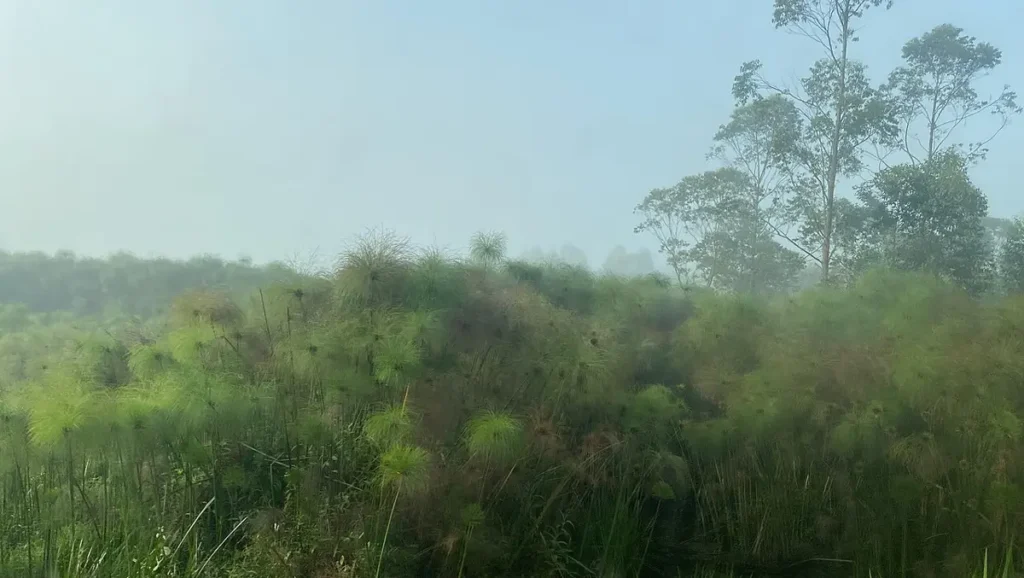
Papyrus (Cyperus papyrus) is a tall sedge plant that forms dense, monospecific stands along the margins of Uganda’s lakes and rivers. Papyrus stands reach four to five metres in height, with each stem topped by a spherical umbel of delicate branchlets that gives the plant its distinctive feathery silhouette. The ancient Egyptians used papyrus stems to manufacture paper — the word paper derives from papyrus — and the plant’s cultural significance extends well beyond Uganda’s borders.
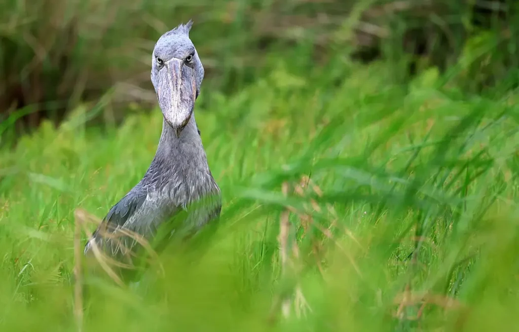
In ecological terms, papyrus swamps perform a range of ecosystem services that make them among Uganda’s most functionally important habitats. They filter pollutants and excess nutrients from agricultural runoff before these reach open water bodies, maintaining water quality in Lake Victoria and other water bodies that the country depends on for drinking water, fisheries, and transport. They store significant quantities of carbon in waterlogged organic soils, making their conversion to agriculture or drainage a climate-relevant concern as well as a biodiversity one. And they provide habitat for specialised species — the shoebill stork, the papyrus gonolek, the papyrus yellow warbler, and the sitatunga antelope — that cannot survive in any other habitat type and that would disappear from Uganda if papyrus swamps were lost.
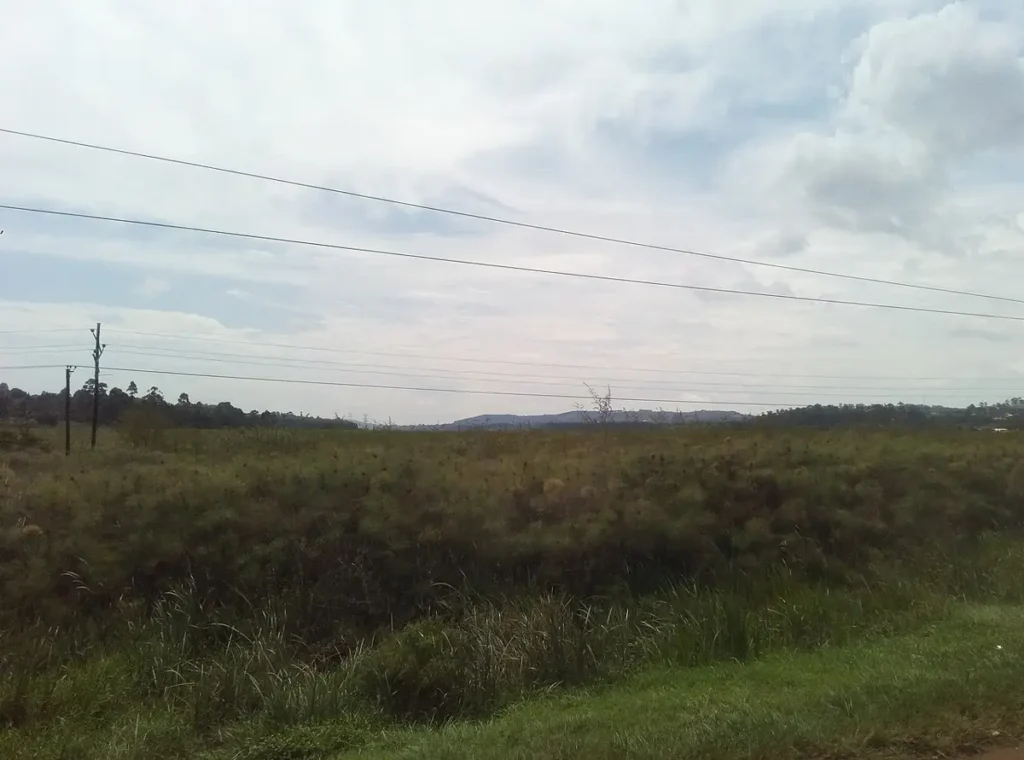
Lake Victoria’s shore papyrus belt has been dramatically reduced by human pressure over the past fifty years. Drainage for sugarcane cultivation, rice farming, and urban expansion has eliminated large sections of shoreline papyrus that previously provided nursery habitat for Victoria’s fish species, including many of the cichlid endemics that make the lake one of the world’s most significant freshwater biodiversity sites. The ecological consequences of this wetland loss continue to unfold across the lake’s fish community and in the livelihoods of millions of people who depend on Lake Victoria fisheries.
The sitatunga: the swamp’s specialist antelope
The sitatunga (Tragelaphus spekii) is a large, shaggy antelope that has evolved to exploit the papyrus swamp environment with anatomical adaptations that allow it to move through dense, waterlogged vegetation where no other large antelope can follow. Its hooves are elongated and splayed to distribute weight over soft ground, its legs are coated with water-repellent oily secretions, and its body is compressed laterally to ease passage through dense stems. Males carry spiral horns that sweep back and upward in a shape that minimises snagging on vegetation during movement through dense stands.
Sitatunga are primarily browsers, feeding on the leaves and stems of papyrus and associated swamp vegetation. They are more active at dawn and dusk than during midday hours and are typically observed by boat or canoe from waterways that intersect their wetland range. Uganda’s best sitatunga viewing sites include the Mabamba Swamp, the wetlands around Lake Mburo, and the shoreline swamps of Lake Bunyonyi in the southwest.
The sitatunga’s ecological specialisation makes it acutely vulnerable to habitat loss. A drained papyrus swamp is not a habitat that sitatunga can adapt to — there is no equivalent replacement available in the degraded landscape that wetland drainage creates. In areas where papyrus extent has declined substantially, sitatunga populations have contracted proportionally, and local extinction has occurred in swamp areas that have been completely converted. The sitatunga’s fate is therefore a direct indicator of papyrus swamp health, and populations that remain robust signal wetland habitats that are functioning effectively.
Wetland birds: the richest avifauna in East Africa
Uganda’s wetland bird community is one of the most diverse in Africa, reflecting the country’s position at the intersection of biomes and the variety of wetland habitats available from papyrus swamp to open lake to seasonal floodplain. The African fish eagle, whose distinctive yelping call is among the most evocative sounds in Africa, is abundant along all major water bodies. The goliath heron, the world’s largest heron standing 1.5 metres tall, hunts in the open shallows of lakes and channels with deliberate patience. The African jacana walks on floating vegetation on elongated toes that distribute its weight across leaf surfaces, an adaptation as elegant and improbable as the sitatunga’s splayed hooves in papyrus.
For birders, the wetland-specialist species endemic or near-endemic to Uganda’s specific wetland types are the primary targets. The papyrus gonolek, a boldly patterned black-and-red shrike restricted entirely to papyrus swamps within Uganda and a few adjacent countries, is one of the most sought-after birds on the Albertine Rift checklist and is reliably found at accessible sites including Mabamba. The papyrus yellow warbler, another papyrus obligate, is equally range-restricted and equally coveted by serious African birders.
The Ramsar designation and international wetland protection
Several of Uganda’s most important wetland sites are designated Ramsar sites — wetlands of international importance under the Convention on Wetlands. Ramsar site designation establishes international visibility, creates reporting obligations to the Ramsar convention secretariat, and provides access to international technical assistance and conservation funding that non-designated sites do not receive.
Uganda’s Ramsar sites include Lake Mburo National Park’s wetlands, the Murchison Falls-Albert Delta wetlands, and the Lake Nakivali wetland system. The designation process requires demonstration of internationally significant wetland values under one or more of the Ramsar criteria covering waterbird populations, fish species, biodiversity, and ecological function. Sites that achieve Ramsar designation typically have robust monitoring programmes and more active conservation management than non-designated sites, making them better places to experience wetland biodiversity.
Visitors to Uganda who experience both the mountain forest ecosystem of Bwindi and the wetland ecosystems of the Victoria Basin or Murchison Delta encounter two entirely different dimensions of the same country’s extraordinary natural heritage. The transition between these ecosystems — the steep green forest of the southwest giving way to the flat, shimmering wetland margins of the lake basin — captures something fundamental about Uganda’s ecological variety that no single habitat experience, however extraordinary, can fully convey. Including wetland destinations in a Uganda gorilla trekking itinerary transforms a one-note wildlife trip into a genuinely comprehensive engagement with one of Africa’s most ecologically complex and rewarding destinations.