
Where the soul of the forest whispers in the mist
Uganda is a land where nature’s contrasts come alive—rising from the fertile plains to snow-capped peaks, sweeping across lush rainforests and shimmering lakes. Positioned within the East African Plateau and sliced by the Great Rift Valley, Uganda is gifted with a variety of dramatic landscapes. Its western edge is defined by the towering Rwenzori Mountains, whose icy summits defy their equatorial location, while the massive caldera of Mount Elgon looms in the east. Between these highlands lie sprawling savannahs, rolling hills, ancient volcanic craters, and river valleys that support a remarkable range of flora and fauna. Uganda is one of the few places on earth where you can witness such striking ecological diversity within a relatively compact space.
Water is the pulse that nourishes this vibrant geography. From the vastness of Lake Victoria—Africa’s largest freshwater lake—to the thunderous plunge of the Nile at Murchison Falls, Uganda’s water bodies are as vital as they are beautiful. Crater lakes, papyrus swamps, and meandering rivers sustain wildlife, feed agriculture, and shape the rhythm of daily life for millions. Uganda’s geography is not just a backdrop; it is the living stage upon which biodiversity thrives, adventure unfolds, and ancient earth stories continue to echo through every mountain trail, forest canopy, and flowing stream.
So lace up your boots, grab your camera, and prepare to meet the wild — this is where your gorilla trekking dreams and unforgettable safari adventures truly begin.

Truly Iconic Highlights in Uganda

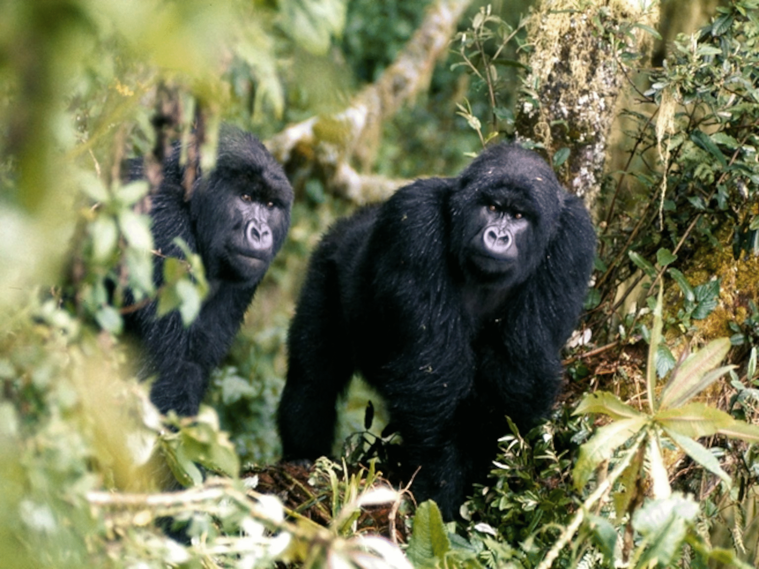
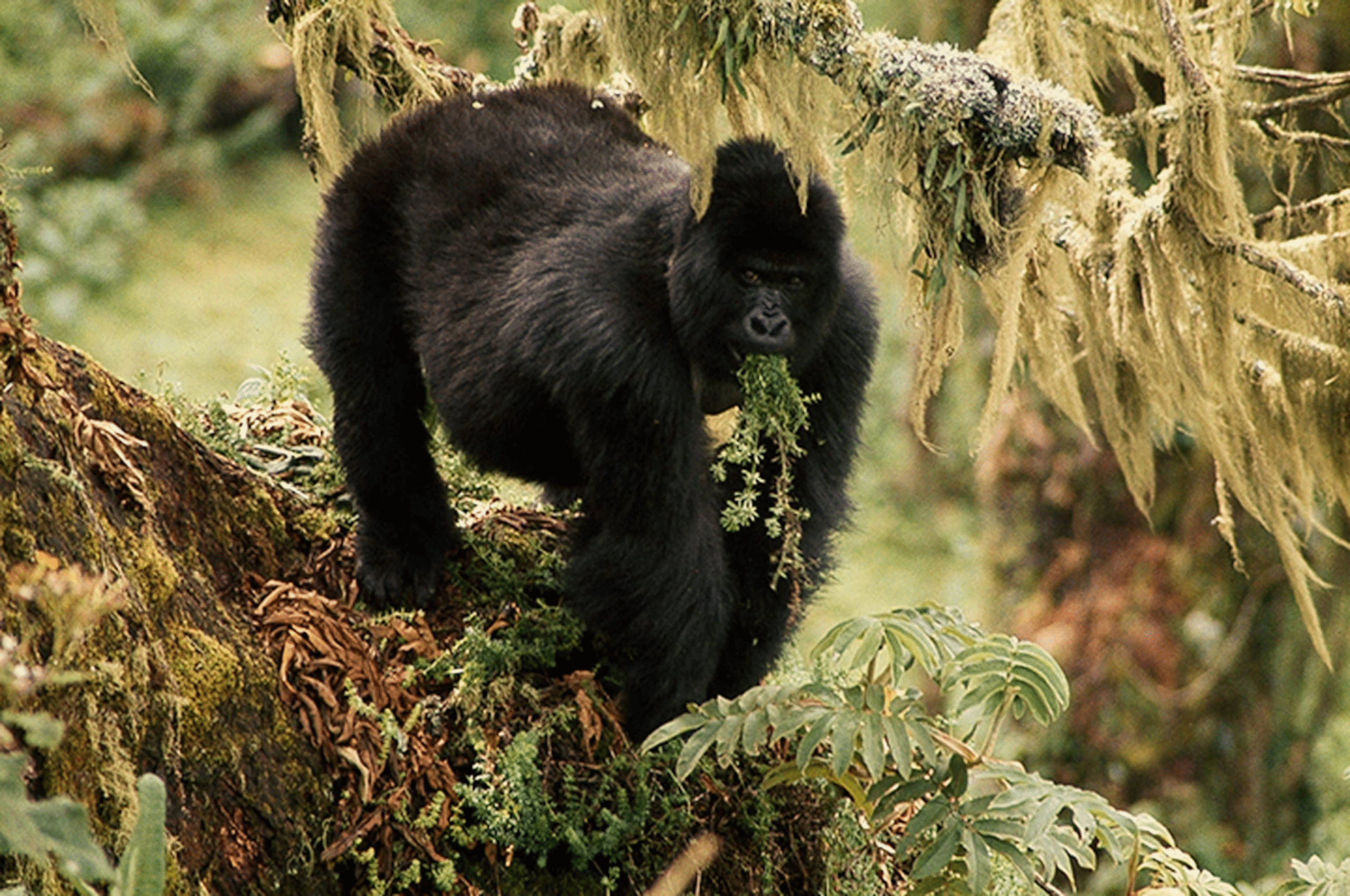
Trek through Bwindi’s mystical rainforest and meet the endangered mountain gorillas in their breathtaking natural home.
Encounter mountain gorillas and golden monkeys on Mgahinga’s misty volcanic trails, where culture and alpine wildlife thrive together.
Unwind after your trek with a peaceful canoe ride across Lake Bunyonyi, Uganda’s most tranquil and scenic highland lake.
Enhance your gorilla trekking safari with an optional chimpanzee encounter in Uganda’s lush forests, adding depth and diversity to your primate adventure
Discover Uganda’s Geography and Natural Features That Shape the Pearl of Africa
Uganda, often celebrated as the Pearl of Africa, is more than just a destination—it’s a living canvas of breathtaking landscapes, rare biodiversity, and complex ecosystems shaped over millennia. Situated right at the heart of East Africa, Uganda is uniquely positioned on the equator, bordered by Kenya to the east, South Sudan to the north, the Democratic Republic of Congo to the west, Rwanda to the southwest, and Tanzania to the south. But what truly sets Uganda apart is not just its location—it’s the immense geographical diversity that unfolds across its valleys, volcanoes, lakes, rivers, plateaus, and dense forests.
Whether you are standing on the misty ridges of the Virunga Volcanoes or watching the sun shimmer over Lake Victoria’s vast waters, Uganda’s geography tells a story of creation, resilience, and a natural rhythm that continues to shape the lives of both wildlife and communities.
The Geographical Heartbeat of Uganda
Uganda lies within the East African Plateau, which means much of the country rests on an elevated base averaging between 1,000 to 1,300 meters above sea level. But don’t let the word “plateau” suggest monotony. This land is anything but flat. From soaring snow-capped mountains to deep rift valleys and ancient crater lakes, Uganda showcases a topographical variety that defies expectation.
The western part of Uganda is dramatically marked by the Western Rift Valley, also known as the Albertine Rift. This is a branch of the greater East African Rift system and perhaps Uganda’s most ecologically significant region. Here, you find Rwenzori Mountains—also called the Mountains of the Moon—towering with jagged peaks and Africa’s third-highest summit, Mount Stanley, rising to 5,109 meters. This mountain range is perpetually cloaked in mist and ice, making it one of the rare places near the equator with permanent glaciers. It is not just a geological marvel but also a biodiversity hotspot.
To the east, the landscape softens into the Elgon Highlands, dominated by Mount Elgon, an extinct shield volcano straddling the Uganda-Kenya border. Unlike the steep and rugged Rwenzori, Mount Elgon has a massive caldera and gentle slopes, making it more accessible for trekkers and farmers who cultivate its fertile volcanic soils. This region is dotted with waterfalls, caves, and bamboo forests, serving both agricultural purposes and ecotourism adventures.
The Lifeblood of Uganda: Rivers and Lakes
Water is a defining feature of Uganda’s geography—so much so that nearly a fifth of the country’s surface area is covered by freshwater bodies. Lake Victoria, Africa’s largest lake by area and the source of the White Nile, sits majestically in the southern part of the country. Its expansive waters not only provide fish and transportation but also influence local climate patterns and support diverse aquatic ecosystems.
Emerging from Lake Victoria is the mighty River Nile, the world’s longest river, which begins its northward journey right from Jinja, Uganda’s adventure capital. This stretch of the Nile—often called the Victoria Nile—cascades through Murchison Falls National Park, where it explodes through a narrow 7-meter gorge and plunges 43 meters below, creating one of the most dramatic waterfalls on the continent. Further north, it merges into Lake Albert before continuing into South Sudan.
Uganda is also home to numerous other lakes, each with its own unique story and ecosystem. Lake Edward, Lake George, Lake Kyoga, and Lake Bunyonyi—the latter being one of Africa’s deepest and most scenic crater lakes—all contribute to the nation’s rich hydrological network.
Forests, Valleys, and Wetlands: Ecological Diversity in Every Corner
Stretching across southwestern Uganda lies the Bwindi Impenetrable Forest, an ancient rainforest that is part of the Albertine Rift and serves as a UNESCO World Heritage Site. Its rugged terrain and dense vegetation make it a refuge for almost half of the world’s remaining mountain gorillas. This forest is more than just a sanctuary; it’s a living relic of a prehistoric era, offering one of the richest ecosystems in Africa, harboring over 120 mammal species, 350 bird species, and countless endemic plants.
Close by, the Kibale Forest National Park hosts the highest density of primates in the world, making Uganda one of the most important primate conservation areas on the planet. These forest ecosystems are intertwined with valleys and wetlands—especially the Mabamba Bay Wetland and Lutembe Bay, both recognized as Ramsar sites due to their importance for migratory bird species like the rare Shoebill Stork.
Uganda’s central and northern regions are largely characterized by wooded savannahs and open grasslands, gradually transitioning into arid and semi-arid lands in the extreme northeast near Kidepo Valley National Park. This remote corner offers dramatic mountain backdrops, rocky outcrops, and golden plains teeming with wildlife—arguably one of Africa’s most visually stunning and least disturbed landscapes.
Climatic Influence and Natural Seasons
Uganda enjoys a tropical climate that is tempered by its elevation, leading to relatively moderate temperatures throughout the year. While it lies along the equator, the highlands ensure it does not experience extreme heat. The country generally experiences two rainy seasons—March to May and September to November—interspersed with dry spells.
However, due to the diverse topography, microclimates are common. For instance, the Rwenzori region experiences near-constant moisture and cloud cover, while areas like Karamoja in the northeast face hotter, drier conditions. This climate variation is vital in sustaining the wide range of ecosystems across Uganda, from montane forests to papyrus swamps and arid plains.
Volcanic Origins and Earth’s Geologic Memory
Uganda’s dramatic landscapes are a direct result of volcanic and tectonic activity. The Virunga Volcanoes, which spill into the southwest corner of the country, are part of a chain of eight volcanoes along the border with Rwanda and the DRC. Among these, Mount Muhabura and Mount Gahinga rise steeply and are popular hiking destinations. Though currently dormant, these volcanoes continue to shape the cultural and ecological makeup of the region.
Further evidence of Uganda’s volcanic past is seen in the many crater lakes that dot the western region, particularly around Fort Portal and Queen Elizabeth National Park. These crater lakes—some still filled with turquoise water, others turned into swamps—are remnants of explosive eruptions and add another layer of geological wonder to Uganda’s already diverse terrain.
More Information About Uganda to Know.
Uganda is a culturally rich and naturally diverse country, home to vibrant traditions, stunning landscapes, and welcoming people. From its deep history to its thriving wildlife and modern identity, Uganda truly stands as the Pearl of Africa.
In the Realm of Giants – Bwindi & Mgahinga in Frames.
Wander through an elegant gallery capturing Uganda’s most exclusive gorilla sanctuaries, where ancient forests cradle the last mountain gorillas in a world of mist, mystery, and majesty.
")
")
")
Essential Planning Tips for Visiting Uganda’s National Parks.
Get ready for the wild heart of Africa with expert travel tips on when to visit, what to pack, where to go, and how to make the most of your safari across Uganda’s breathtaking national parks.
Why Uganda for Gorilla Trekking?
Uganda is not just a destination — it's the very soul of gorilla trekking. With over half of the world’s remaining mountain gorillas calling its misty forests home, Uganda offers the rarest encounters in their most authentic setting. Here, your journey is not rushed or crowded. Instead, you’re guided by experienced rangers through pristine jungles where gorillas live as they always have — wild, free, and magnificent
From insider travel insights to unforgettable trekking guides, our blog is your trusted path into Uganda’s wild heart — connecting you with mountain gorillas, breathtaking landscapes, and the soul-stirring adventures that make this land unlike any other.