
Where the soul of the forest whispers in the mist
Mgahinga Gorilla National Park is situated in southwestern Uganda, nestled within the Virunga volcanic mountain range at the tri-point borders of Uganda, Rwanda, and the Democratic Republic of Congo (DRC). Despite being Uganda’s smallest national park, covering only 33 square kilometers, its strategic location gives it immense ecological, cultural, and touristic importance. The park is part of the Albertine Rift, a biodiversity hotspot known for high species endemism and ecological uniqueness.
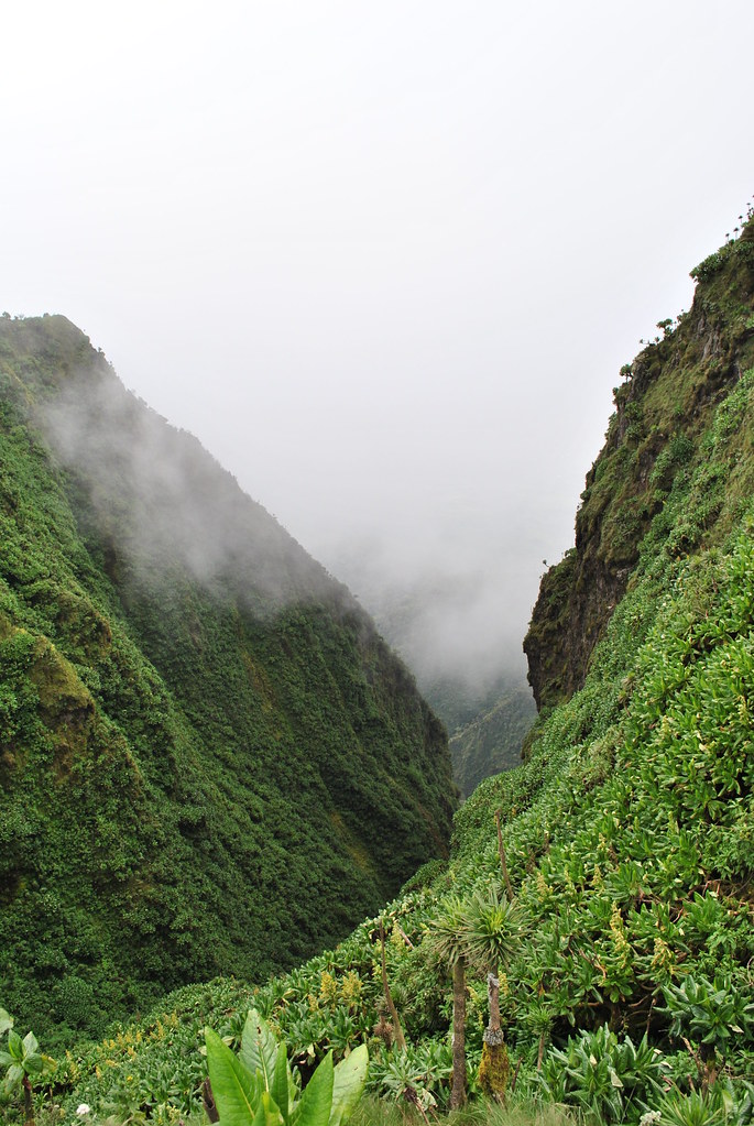
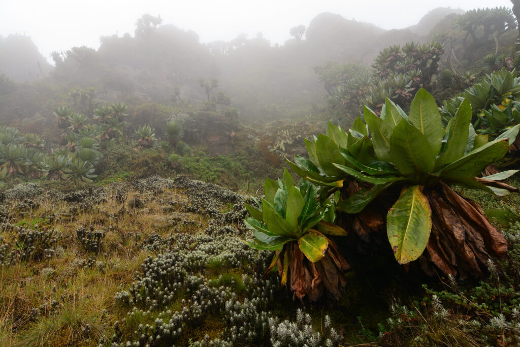
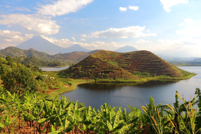
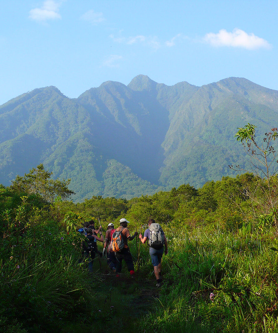
The park’s location at high altitudes ranging from 2,227 to 4,127 meters above sea level contributes to its diverse habitats, including lower montane forests, bamboo belts, afro-alpine vegetation, wetlands, and volcanic crater lakes. Its volcanic peaks—Mount Muhabura, Mount Gahinga, and Mount Sabyinyo—dominate the landscape, providing dramatic scenery and ecological niches that support rare species such as mountain gorillas and golden monkeys Being located near international borders, Mgahinga plays a critical role in transboundary conservation initiatives.
So lace up your boots, grab your camera, and prepare to meet the wild — this is where your gorilla trekking dreams and unforgettable safari adventures truly begin.
Truly Iconic Highlights in Uganda

Trek through Bwindi’s mystical rainforest and meet the endangered mountain gorillas in their breathtaking natural home.
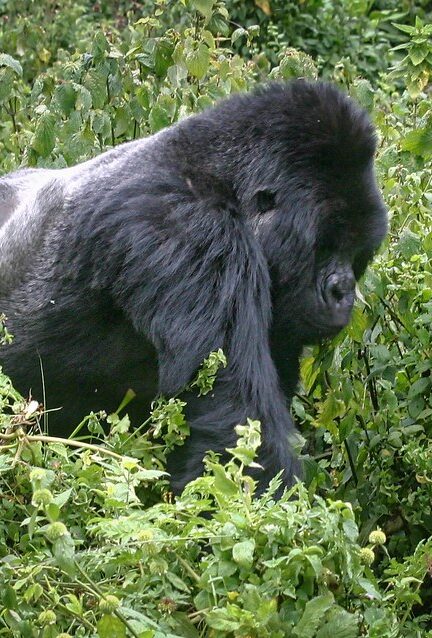
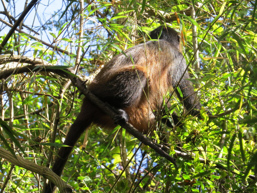
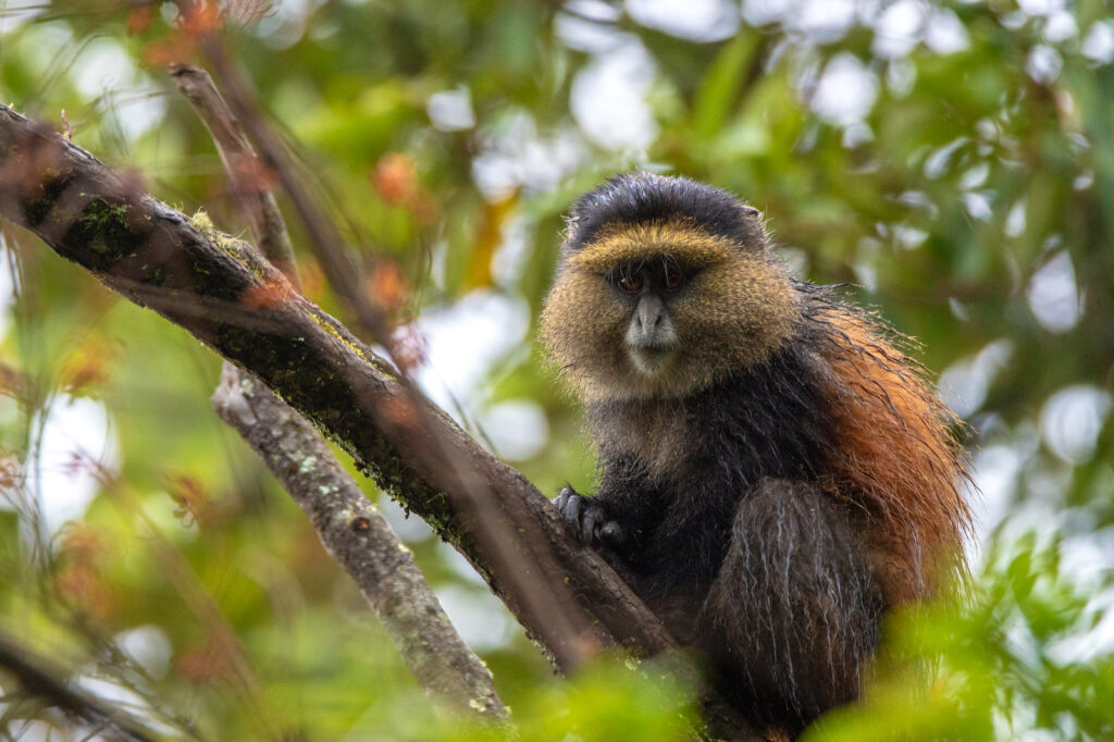
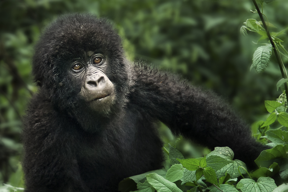
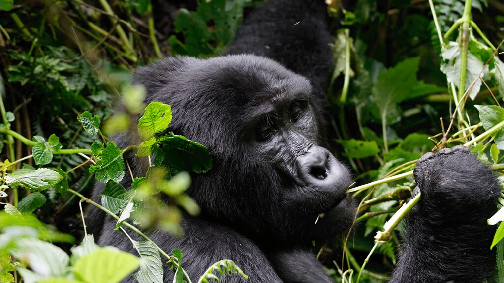
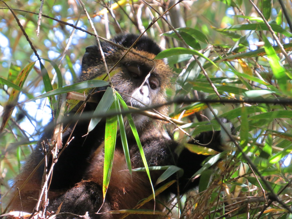
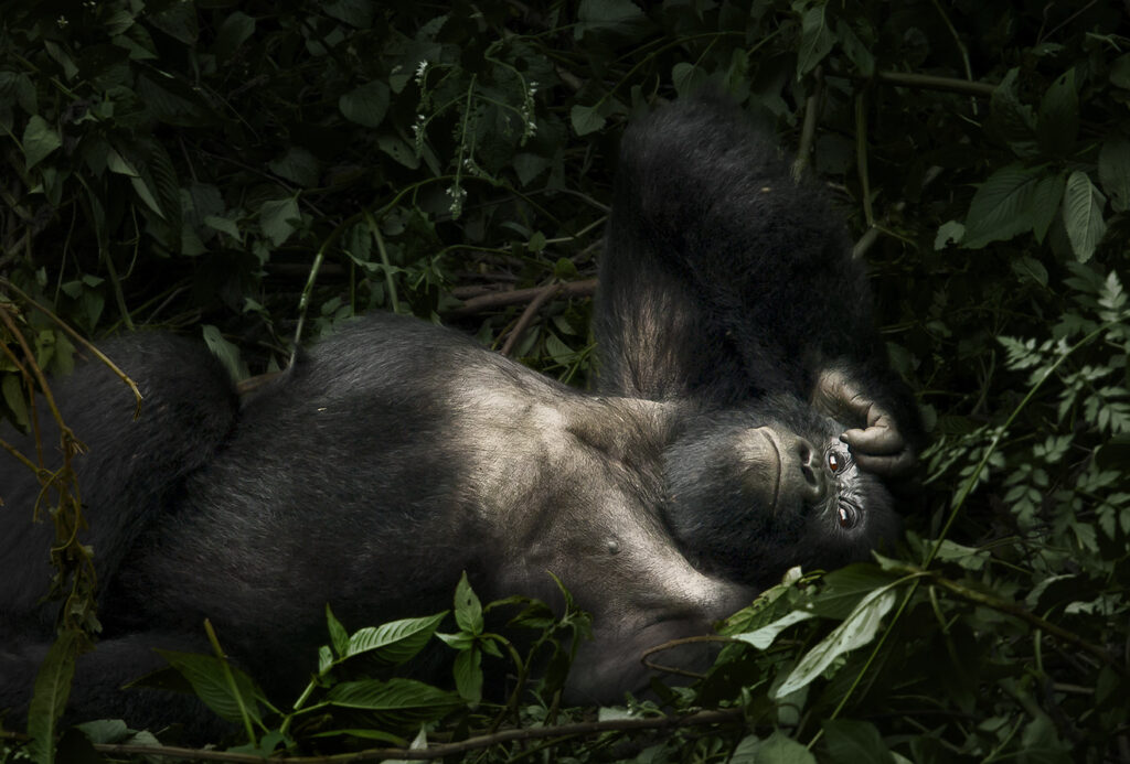
Encounter mountain gorillas and golden monkeys on Mgahinga’s misty volcanic trails, where culture and alpine wildlife thrive together.
Unwind after your trek with a peaceful canoe ride across Lake Bunyonyi, Uganda’s most tranquil and scenic highland lake.
Enhance your gorilla trekking safari with an optional chimpanzee encounter in Uganda’s lush forests, adding depth and diversity to your primate adventure
A DETAILED STUDY OF MGAHINGA’S GEOGRAPHICAL COORDINATES AND LOCATION
Geographical coordinates
Mgahinga is positioned approximately 480 kilometers southwest of Kampala, Uganda’s capital, at 1.3583°S latitude and 29.6667°E longitude. These coordinates situate the park within tropical highlands of the Albertine Rift, a geologically active region renowned for its volcanic soils, steep slopes, and high rainfall. The park’s precise location plays a critical role in shaping its climate, vegetation, and wildlife. Cooler temperatures at higher altitudes support afro-alpine vegetation, while lower montane slopes are rich in forests and bamboo belts. The geographical positioning also affects accessibility, ensuring that Kisoro remains the primary hub for park operations, trekking orientation, and logistical support for visitors.
Proximity to nearby towns and landmarks
The park lies in close proximity to Kisoro town, only about 30 kilometers from the Ntebeko Visitor Centre, which serves as the main entry point for treks and guided tours. Kisoro provides essential amenities, including lodging, dining, and transportation services. In addition, Kabale, approximately 78 kilometers away, offers an alternative access route for visitors traveling from Kampala or other regions of Uganda. Nearby landmarks such as Lake Bunyonyi, one of Africa’s deepest lakes, enrich the area with scenic beauty and cultural importance. Surrounding communities, including the Batwa, Bakiga, and Bafumbira peoples, contribute to a vibrant cultural landscape, giving tourists opportunities to engage with local traditions, crafts, and sustainable practices that complement conservation efforts.
Ecological significance of the location
Mgahinga’s placement within the Virunga volcanic range creates ecological connectivity with neighboring protected areas, forming vital wildlife corridors that support species migration and genetic exchange. The tri-national landscape allows endangered species, particularly mountain gorillas and golden monkeys, to move across borders in search of food and shelter. The park’s location also facilitates joint conservation programs with Rwanda and the Democratic Republic of Congo, ensuring coordinated monitoring and protection of critical habitats. This ecological positioning enhances the resilience of ecosystems and underscores Mgahinga’s role as a key node within the Greater Virunga Landscape.
Altitude and climate influence
Mgahinga’s altitudinal range spans from 2,227 meters at the park base to 4,127 meters at Mount Muhabura’s summit. This elevation gradient creates a variety of microclimates, from warm and humid lower slopes to cooler, mist-laden upper peaks. Annual rainfall ranges from 1,200 to 1,800 millimeters, sustaining lush vegetation, fertile soils, and abundant water sources. The altitude and climate diversity underpin distinct vegetation zones, from montane forests and bamboo belts to afro-alpine grasslands and wetlands. Wildlife behavior is closely tied to these zones, as gorillas, golden monkeys, and specialized bird species utilize habitats at specific elevations depending on food availability and shelter. The climatic conditions also impact trekking experiences, requiring visitors to prepare for sudden weather changes and variable temperatures across altitudes.
Accessibility and regional positioning
Mgahinga’s strategic location enhances its significance for tourism and conservation. Situated along international borders, the park is well-positioned for cross-border eco-tourism, multi-country gorilla trekking adventures, and regional research collaborations. Its placement allows Uganda to participate in initiatives such as the Greater Virunga Landscape program, coordinating conservation strategies across national boundaries. Most travelers access the park via road from Kampala or by air via charter flights to Kisoro Airstrip, followed by transfers to Ntebeko Visitor Centre. Awareness of the park’s location helps visitors plan logistics, travel times, and accommodation while maximizing their experience of the park’s natural and cultural treasures.
Cultural and community context
Mgahinga’s location intersects with indigenous and local communities that have historically relied on forest resources for survival. The Batwa, a pygmy hunter-gatherer group, have inhabited these forests for centuries, practicing sustainable subsistence activities and maintaining deep ecological knowledge. The Bakiga and Bafumbira communities cultivate the surrounding hills and engage in eco-tourism initiatives, contributing to both conservation and local livelihoods. Proximity to these communities provides unique cultural tourism opportunities, allowing visitors to learn about traditional forest stewardship, indigenous knowledge systems, and sustainable land use practices that are intertwined with conservation outcomes.
Strategic importance for conservation
The park’s location is central to Uganda’s broader conservation strategy, particularly in maintaining biodiversity corridors and protecting endangered species. Being part of the Virunga volcanic range, Mgahinga allows mountain gorillas and other wildlife to move between protected areas in Uganda, Rwanda, and DRC, supporting genetic diversity and population resilience. Safeguarding this location strengthens regional conservation efforts, promotes sustainable tourism, and ensures ecological integrity. Mgahinga serves as a model for how strategic positioning, combined with habitat protection and community engagement, can support both biodiversity conservation and human development.
Visitor experience and scenic value
Visitors to Mgahinga experience the park’s location through its breathtaking volcanic landscapes, crater lakes, and rolling highlands often cloaked in mist. The geographical context enhances photographic opportunities, trekking adventures, and cultural immersion. Understanding the park’s coordinates, altitude, climate, and proximity to communities enriches the visitor experience by illustrating how natural and human factors converge to create one of Uganda’s most extraordinary conservation areas. The location not only supports biodiversity but also elevates tourism, providing visitors with unparalleled opportunities to witness the intersection of ecology, geology, and culture.
More Mgahinga Information to Know.
Mgahinga Gorilla National Park is a compact, high-altitude park in southwestern Uganda, defined by dramatic volcanic mountains and afro-montane forest. Its cool climate, rare vegetation, golden monkey habitat, rich cultural heritage, and strong conservation focus make it a unique and rewarding destination for primate and nature experiences.
Mgahinga Climate
Mgahinga Climate
Mgahinga Geography & Geology
Mgahinga Geography & Geology
Mgahinga History
Mgahinga History
Mgahinga Vegetation
Mgahinga Vegetation
Ntebeko Visitor Centre
Ntebeko Visitor Centre
Mgahinga Biodiversity
Mgahinga Biodiversity
Mgahinga FAQs Information
Mgahinga FAQs Information
Getting There To Mgahinga
Getting There To Mgahinga
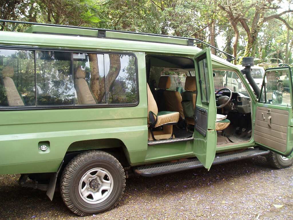
Self Drive
Self Drive
Mgahinga Altitude
Mgahinga Altitude
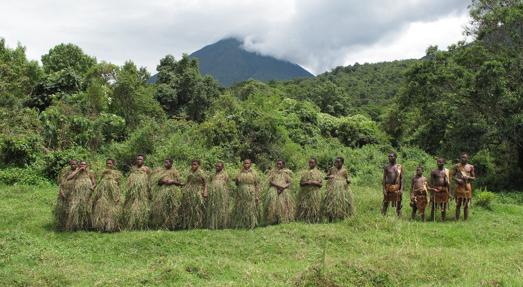
Batwa Trail
Batwa Trail
In the Realm of Giants – Bwindi & Mgahinga in Frames.
Wander through an elegant gallery capturing Uganda’s most exclusive gorilla sanctuaries, where ancient forests cradle the last mountain gorillas in a world of mist, mystery, and majesty.


Essential Planning Tips for Visiting Uganda’s National Parks.
Get ready for the wild heart of Africa with expert travel tips on when to visit, what to pack, where to go, and how to make the most of your safari across Uganda’s breathtaking national parks.
Why Uganda for Gorilla Trekking?
Uganda is not just a destination — it's the very soul of gorilla trekking. With over half of the world’s remaining mountain gorillas calling its misty forests home, Uganda offers the rarest encounters in their most authentic setting. Here, your journey is not rushed or crowded. Instead, you’re guided by experienced rangers through pristine jungles where gorillas live as they always have — wild, free, and magnificent
From insider travel insights to unforgettable trekking guides, our blog is your trusted path into Uganda’s wild heart — connecting you with mountain gorillas, breathtaking landscapes, and the soul-stirring adventures that make this land unlike any other.