
Where the soul of the forest whispers in the mist
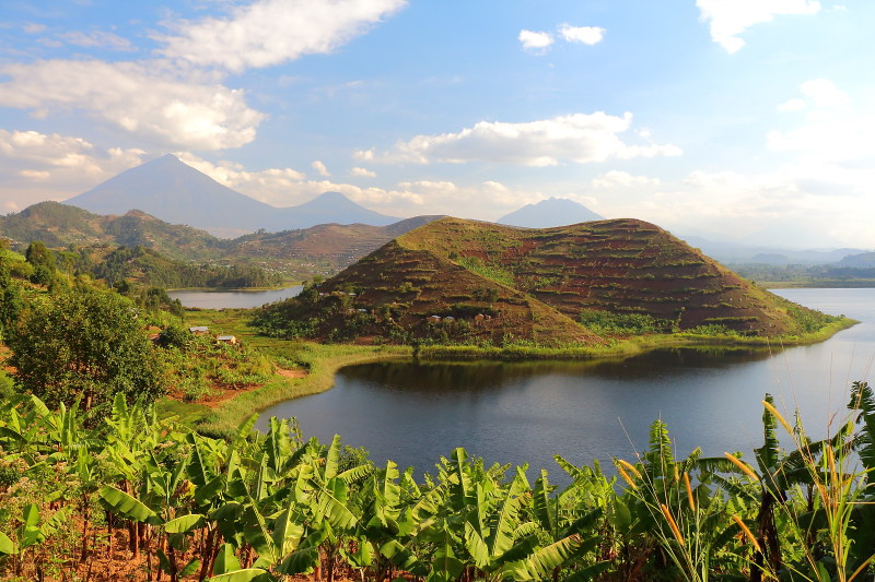
Mgahinga Gorilla National Park is located in southwestern Uganda at the meeting point of Uganda, Rwanda, and the Democratic Republic of Congo. This strategic location places the park within the larger Virunga Conservation Area, a globally significant transboundary ecosystem known for its volcanic landscapes, unique biodiversity, and ecological importance. Despite being Uganda’s smallest national park, covering just under 34 square kilometers, Mgahinga holds outsized ecological and geological significance due to its location within the Albertine Rift, one of the most biologically and geologically dynamic regions in Africa. The park rises sharply from cultivated lowlands into a chain of extinct volcanoes, creating a striking contrast between human-influenced areas and protected high-altitude wilderness.
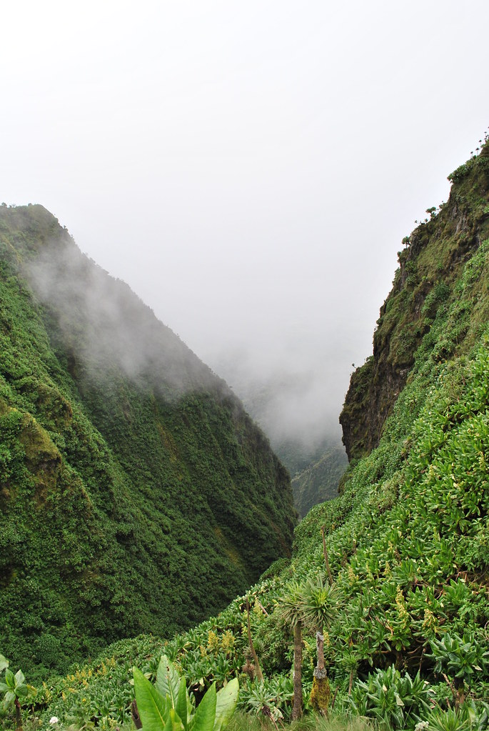
Altitude and volcanic topography define Mgahinga’s geography, with elevations ranging from arouAltitude and volcanic topography define Mgahinga’s geography, with elevations ranging from around 2,227 meters at the park’s lower edges to over 4,127 meters at Mount Muhabura’s summit. This steep gradient produces a cool, moist climate, frequent mist cover, and high rainfall, all of which shape soil formation, vegetation zones, and wildlife movement. The combination of compact size and dramatic elevation makes Mgahinga visually and ecologically unique, providing an ideal setting for specialized montane species, including mountain gorillas, golden monkeys, and rare birdlife.nd 2,227 meters at the park’s lower edges to over 4,127 meters at Mount Muhabura’s summit.
So lace up your boots, grab your camera, and prepare to meet the wild — this is where your gorilla trekking dreams and unforgettable safari adventures truly begin.
Truly Iconic Highlights in Uganda

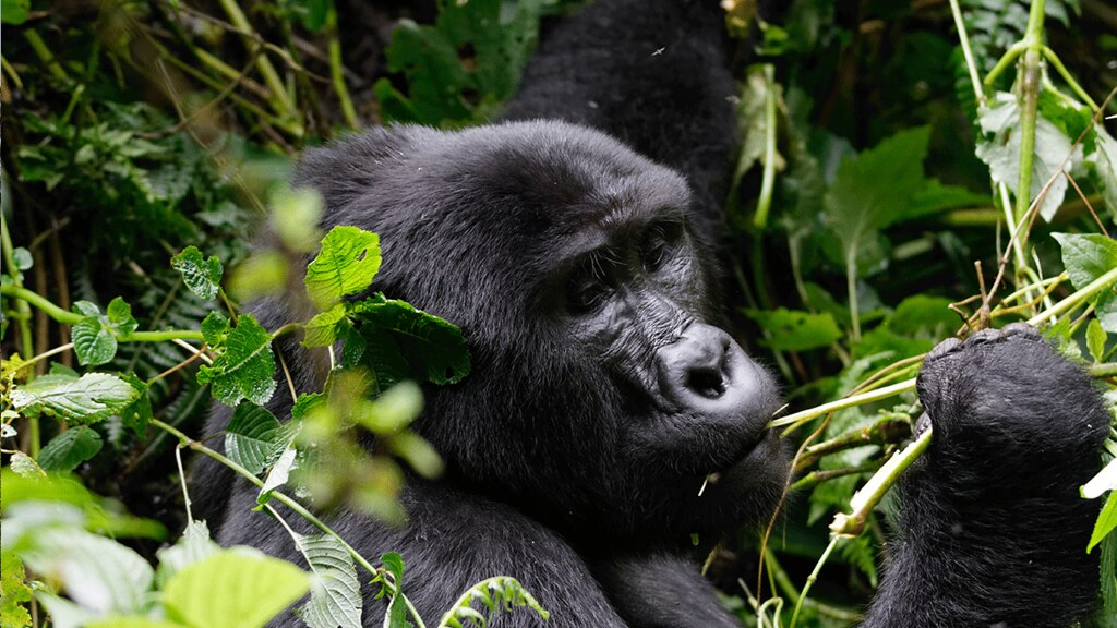
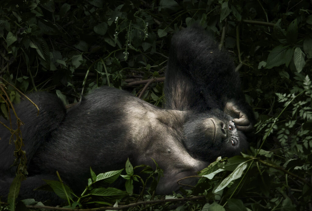
Trek through Bwindi’s mystical rainforest and meet the endangered mountain gorillas in their breathtaking natural home.
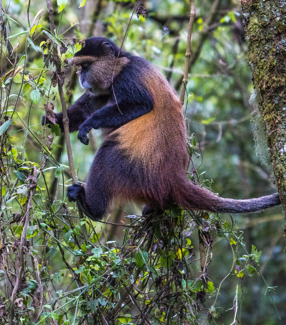
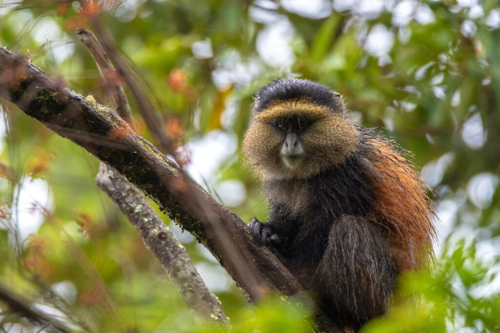
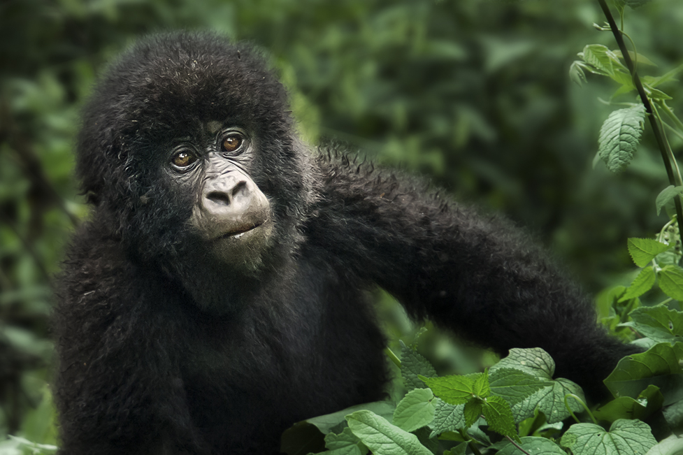
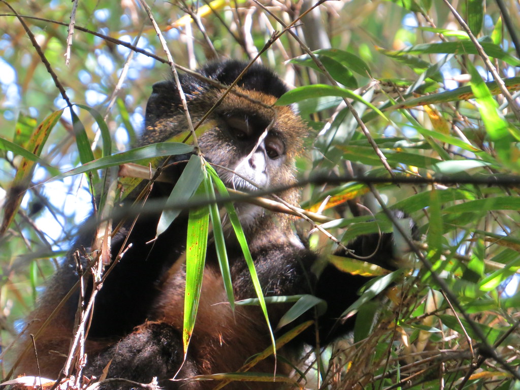
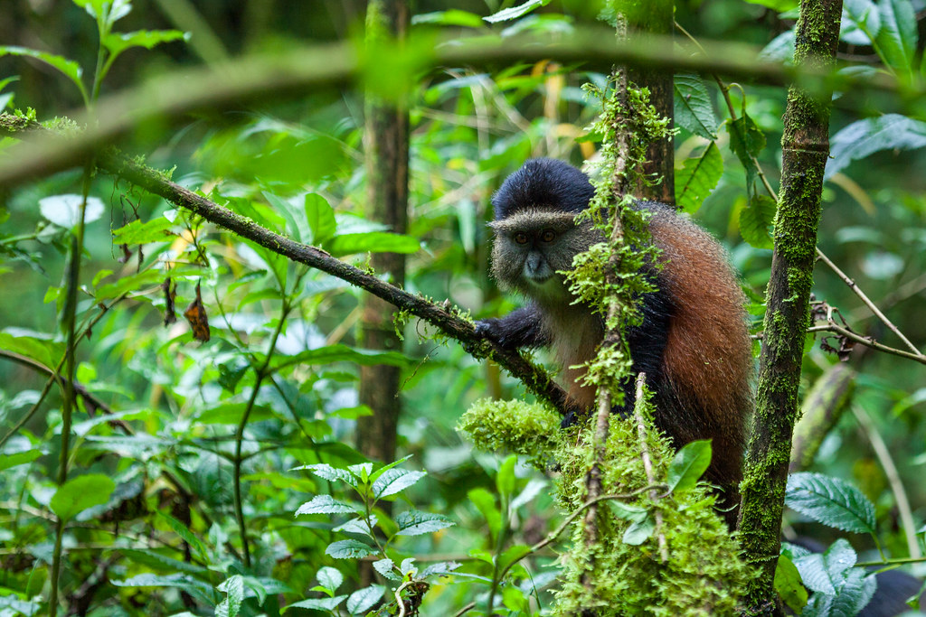
Encounter mountain gorillas and golden monkeys on Mgahinga’s misty volcanic trails, where culture and alpine wildlife thrive together.
Unwind after your trek with a peaceful canoe ride across Lake Bunyonyi, Uganda’s most tranquil and scenic highland lake.
Enhance your gorilla trekking safari with an optional chimpanzee encounter in Uganda’s lush forests, adding depth and diversity to your primate adventure
A DETAILED GEOGRAPHY AND GEOLOGY STUDY OF MGAHINGA GORILLA NATIONAL PARK STRUCTURE
Volcanic Origins and the Virunga Mountain Chain
Mgahinga’s topography and ecological richness are inseparable from its geological history. The park is part of the Virunga volcanic chain, a series of volcanoes created by tectonic activity along the western branch of the East African Rift System. Over millions of years, tectonic movements caused fractures in the Earth’s crust, allowing magma to rise and erupt, gradually forming massive volcanic cones and plateaus. This geological activity has produced the steep slopes, ridges, and valleys that define Mgahinga today. Although the volcanoes within the park are extinct, they remain central to the region’s dramatic relief and contribute directly to its soil fertility and biodiversity. The Virunga volcanic chain also shapes Mgahinga’s elevation and climate patterns, creating a vertical landscape with sharply defined ecological zones. These geological features determine rainfall distribution, wind patterns, and the formation of microhabitats that support a wide variety of plant and animal species. The park’s volcanic origin explains why it contains one of the most ecologically concentrated montane systems in East Africa, with multiple distinct habitats compressed into a small area.
Mount Muhabura, Mount Gahinga, and Mount Sabyinyo
Three extinct volcanoes dominate Mgahinga’s landscape, each with unique geological characteristics. Mount Muhabura is the tallest and most symmetrical, forming a near-perfect cone that rises sharply from its base. Its slopes consist of solidified lava flows and volcanic ash layers, which have weathered into fertile soils that sustain dense montane forest cover. Muhabura’s high altitude also influences temperature and vegetation distribution, creating cooler conditions suitable for specialized afro-alpine flora and fauna. Mount Gahinga is lower and features a broad, swamp-filled crater, reflecting a less explosive eruptive history dominated by lava effusions rather than violent eruptions. The wetland within its crater supports unique plant communities and contributes to the park’s hydrological system. Mount Sabyinyo, with its jagged peaks, marks the tri-border point between Uganda, Rwanda, and the Democratic Republic of Congo. Its deeply eroded slopes and exposed rock layers illustrate the long-term effects of erosion on volcanic mountains, highlighting the park’s geological diversity and history.
Altitude, Relief, and Landscape Structure
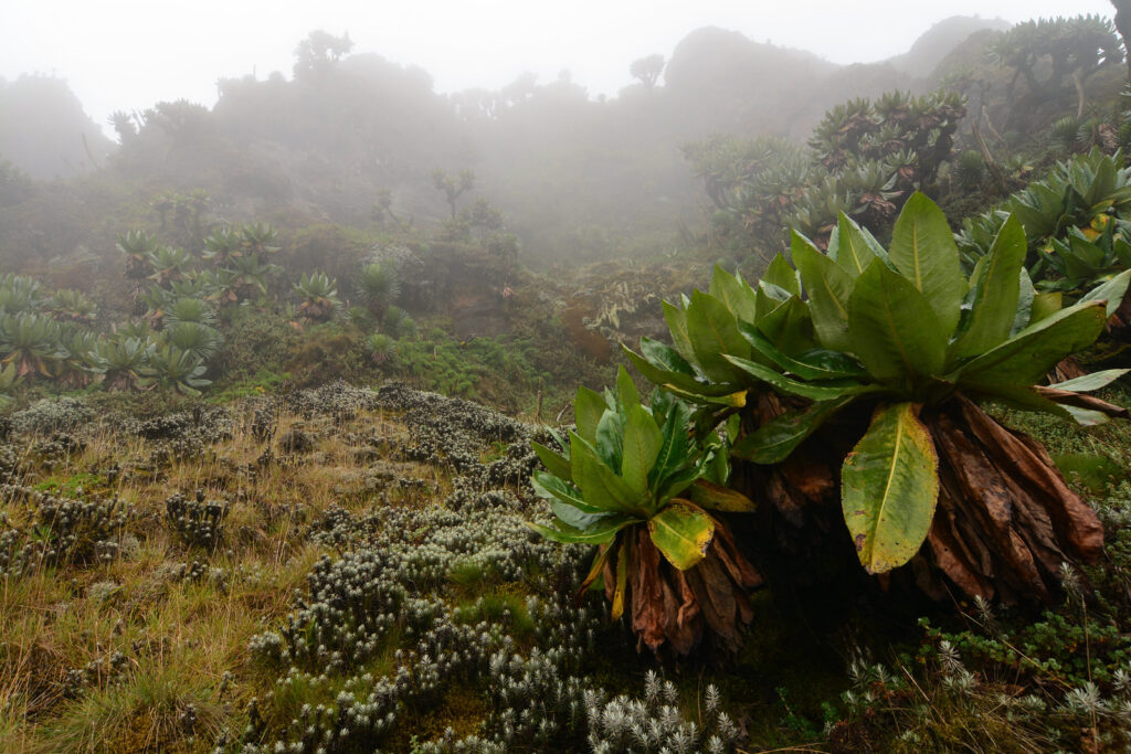
Altitude is the defining factor in Mgahinga’s landscape. The park’s steep gradients create a vertical range of nearly 2,000 meters, producing diverse microclimates over short distances. Lower slopes feature warmer, humid conditions suitable for montane forests, while higher altitudes experience cooler temperatures and harsher winds that shape afro-alpine vegetation. This vertical zoning influences wildlife distribution, with species migrating seasonally along altitude gradients to find optimal food and shelter. Rugged relief further enhances ecological diversity, as narrow ridges, valleys, and erosion channels produce isolated habitats that encourage species specialization. The steep slopes also limit human encroachment, providing natural protection for endangered wildlife. This combination of altitude and relief makes Mgahinga an ecologically rich and geologically complex park despite its small area.
Volcanic Soils and Vegetation Zonation
Volcanic soils are one of Mgahinga’s most important features, formed from the weathering of lava and ash. These soils are rich in nutrients and support dense vegetation, particularly the bamboo forests that dominate mid-altitude zones. Bamboo provides a crucial food source for mountain gorillas and golden monkeys, influencing their habitat selection and feeding behavior. Fertile volcanic soils also support montane hardwood forests at lower elevations and afro-alpine grasses and shrubs near the peaks.Vegetation closely follows changes in altitude and soil depth, with distinct ecological zones stacked along the slopes. This natural zoning compresses a wide range of habitats into a small area, creating unique opportunities for biodiversity conservation and ecological research. Soil fertility, moisture retention, and slope stability all interact with geology to determine which plant communities can thrive at each elevation.
Hydrology and Drainage Patterns
Mgahinga’s hydrology is strongly influenced by its volcanic geology. Porous lava and ash layers allow rainwater to infiltrate underground, reducing surface runoff and limiting the formation of large rivers. Instead, small streams and springs emerge along the lower slopes, providing water for both wildlife and surrounding human communities. These streams eventually feed into larger rivers beyond the park’s boundaries, illustrating the park’s role in regional water supply and ecosystem services. Frequent rainfall and cloud moisture are critical for sustaining the park’s vegetation, particularly during drier seasons. Mist and fog at higher altitudes maintain soil moisture, supporting mosses, ferns, and other moisture-dependent species. The interaction of geology, climate, and hydrology creates a stable yet dynamic environment essential for Mgahinga’s ecological integrity.
The Albertine Rift and Ongoing Geological Influence
Mgahinga lies within the Albertine Rift, a highly geologically active region that contributes to the park’s high elevation, steep escarpments, and rugged terrain. Rifting has caused uplift, faulting, and localized seismic activity, which in turn influence vegetation distribution and species endemism. Although Mgahinga’s volcanoes are extinct, nearby active volcanoes remind us that the region remains geologically dynamic.The park’s rift setting enhances its conservation and scientific value, offering opportunities to study the links between tectonics, volcanism, and biodiversity. The combination of extinct volcanic peaks, fertile soils, and vertical ecological zoning creates a unique natural laboratory for understanding montane ecosystems in East Africa.
More Mgahinga Information to Know.
Mgahinga Gorilla National Park is a compact, high-altitude park in southwestern Uganda, defined by dramatic volcanic mountains and afro-montane forest. Its cool climate, rare vegetation, golden monkey habitat, rich cultural heritage, and strong conservation focus make it a unique and rewarding destination for primate and nature experiences.
Mgahinga Climate
Mgahinga Climate
Mgahinga History
Mgahinga History
Mgahinga Vegetation
Mgahinga Vegetation
Ntebeko Visitor Centre
Ntebeko Visitor Centre
Mgahinga Biodiversity
Mgahinga Biodiversity
Mgahinga FAQs Information
Mgahinga FAQs Information
Getting There To Mgahinga
Getting There To Mgahinga
Mgahinga Location
Mgahinga Location
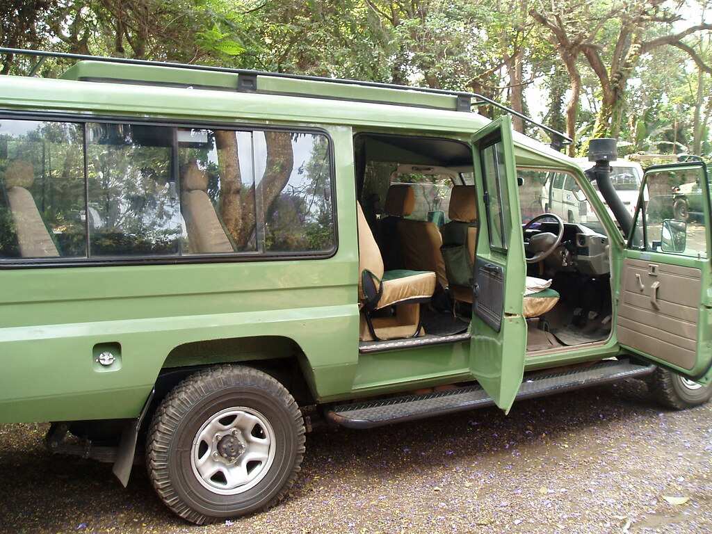
Self Drive
Self Drive
Mgahinga Altitude
Mgahinga Altitude
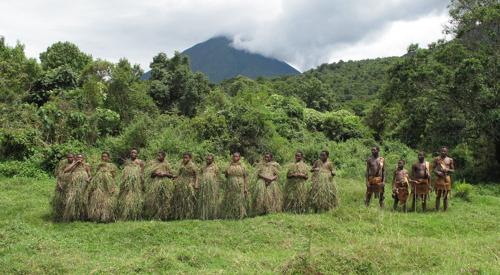
Batwa Trail
Batwa Trail
In the Realm of Giants – Bwindi & Mgahinga in Frames.
Wander through an elegant gallery capturing Uganda’s most exclusive gorilla sanctuaries, where ancient forests cradle the last mountain gorillas in a world of mist, mystery, and majesty.


Essential Planning Tips for Visiting Uganda’s National Parks.
Get ready for the wild heart of Africa with expert travel tips on when to visit, what to pack, where to go, and how to make the most of your safari across Uganda’s breathtaking national parks.
Why Uganda for Gorilla Trekking?
Uganda is not just a destination — it's the very soul of gorilla trekking. With over half of the world’s remaining mountain gorillas calling its misty forests home, Uganda offers the rarest encounters in their most authentic setting. Here, your journey is not rushed or crowded. Instead, you’re guided by experienced rangers through pristine jungles where gorillas live as they always have — wild, free, and magnificent
From insider travel insights to unforgettable trekking guides, our blog is your trusted path into Uganda’s wild heart — connecting you with mountain gorillas, breathtaking landscapes, and the soul-stirring adventures that make this land unlike any other.